
The Ledford Cabin
Grocery and Restaurants
Thirty minute drive from the cabin.
Small country store with food items, beer, and gas. They do not sell any electronics or charging devices of any kind. Not Dougs Country Kitchen next door has breakfast items and a large selection of Sammie Sandwiches. My favorite is the Kickin Chicken Sammie:) They also have espresso and milkshakes. Excellent food, service, and prices.
Store Hours: 8am - 6pm seven days a week
Not Dougs Country Kitchen
Hours: Mon-Fri 8am-3pm Sat and Sun 8am-5pm

Aeneas Valley Country Store
1165 Aeneas Valley RdThirty minute drive from the cabin.
Small country store with food items, beer, and gas. They do not sell any electronics or charging devices of any kind. Not Dougs Country Kitchen next door has breakfast items and a large selection of Sammie Sandwiches. My favorite is the Kickin Chicken Sammie:) They also have espresso and milkshakes. Excellent food, service, and prices.
Store Hours: 8am - 6pm seven days a week
Not Dougs Country Kitchen
Hours: Mon-Fri 8am-3pm Sat and Sun 8am-5pm
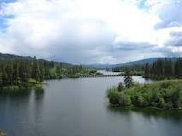
Lakes
45 minute drive from the cabin
Great lake for fishing
Crawfish Lake is a small lake located 15 miles northeast of Omak, Washington. The lake has a surface area of 80 acres and is located at 4,475 ft above sea level. The northeast portion of the lake borders the Okanogan–Wenatchee National Forest, and the south half is on the Colville Indian Reservation
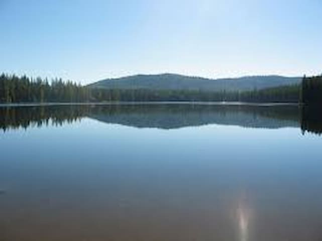
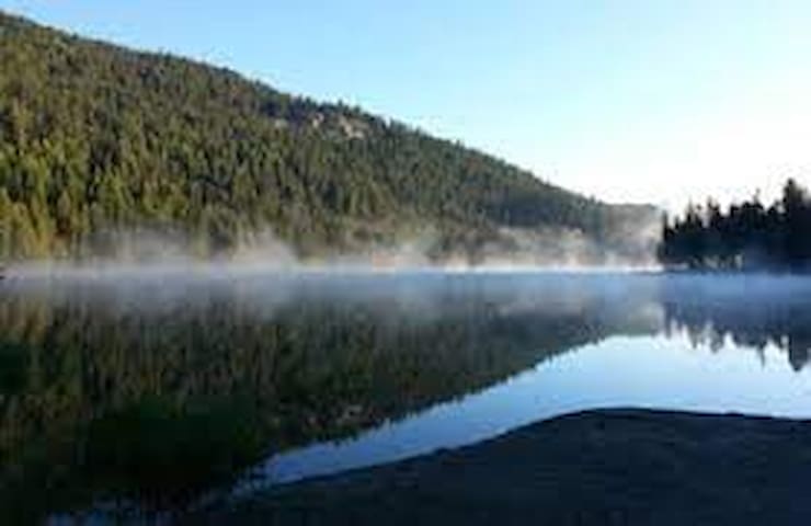
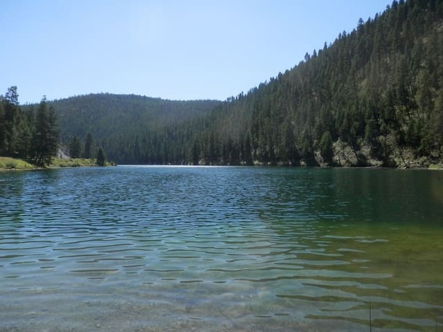
Crawfish Lake
45 minute drive from the cabin
Great lake for fishing
Crawfish Lake is a small lake located 15 miles northeast of Omak, Washington. The lake has a surface area of 80 acres and is located at 4,475 ft above sea level. The northeast portion of the lake borders the Okanogan–Wenatchee National Forest, and the south half is on the Colville Indian Reservation
Little over an hour drive from the cabin.
Swan Lake is a 52 acre, 95’ deep lake at 3,641’ elevation. Excellent for casual hiking, moderate level mountain biking, fly fishing and large group picnicking and camping. Swan Lake is a beautifully clear, quiet lake with an abundance of recreation opportunity and wildlife viewing. A pair of resident loons can be viewed here throughout most of the summer.
Swan Lake Kitchen is a historical site, suited for up to 35 people, on the north end of the lake near the swimming beach available for reservation. Along with a stone fireplace, Swan Lake Kitchen group campground also provides drinking water, a campfire ring, several picnic tables, vault toilets.
There is a public boat launch which is located at the southeast end of the lake, and a swim beach further north. There is a large parking lot near the boat launch for vehicles and trailers. Access to shoreline fishing and boat fishing is good as there are multiple trails leading from the campground to openings along the eastern riparian shore.
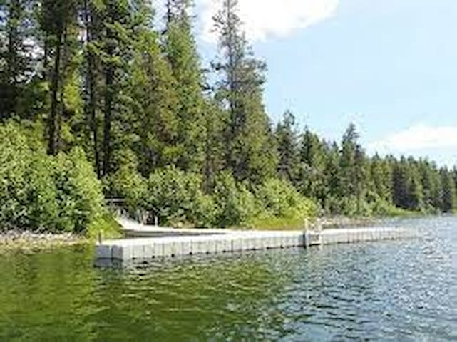
Swan Lake
Little over an hour drive from the cabin.
Swan Lake is a 52 acre, 95’ deep lake at 3,641’ elevation. Excellent for casual hiking, moderate level mountain biking, fly fishing and large group picnicking and camping. Swan Lake is a beautifully clear, quiet lake with an abundance of recreation opportunity and wildlife viewing. A pair of resident loons can be viewed here throughout most of the summer.
Swan Lake Kitchen is a historical site, suited for up to 35 people, on the north end of the lake near the swimming beach available for reservation. Along with a stone fireplace, Swan Lake Kitchen group campground also provides drinking water, a campfire ring, several picnic tables, vault toilets.
There is a public boat launch which is located at the southeast end of the lake, and a swim beach further north. There is a large parking lot near the boat launch for vehicles and trailers. Access to shoreline fishing and boat fishing is good as there are multiple trails leading from the campground to openings along the eastern riparian shore.
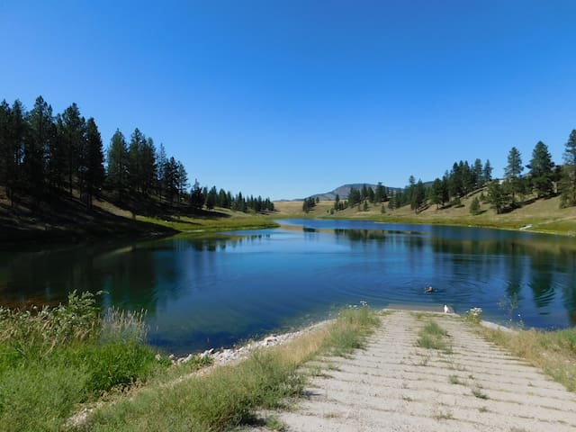
Lyman Lake Campground
40 minute drive from the cabin
An alpine lake with boating and fishing
45 minute drive from the cabin
Fishing is a popular activity on the lake, with anglers enjoying boat fishing for rainbow, brook, and cutthroat trout as well as using the accessible fishing dock. A boat launch area is available in the campground. Kayaking, canoeing, and swimming can also be enjoyed. Hiking around the lake or up the Pipsissewa Trail, which is accessed from the southern loop, are popular activities. Taking a bike ride on the surrounding roads is also available.

Bonaparte Lake
45 minute drive from the cabin
Fishing is a popular activity on the lake, with anglers enjoying boat fishing for rainbow, brook, and cutthroat trout as well as using the accessible fishing dock. A boat launch area is available in the campground. Kayaking, canoeing, and swimming can also be enjoyed. Hiking around the lake or up the Pipsissewa Trail, which is accessed from the southern loop, are popular activities. Taking a bike ride on the surrounding roads is also available.
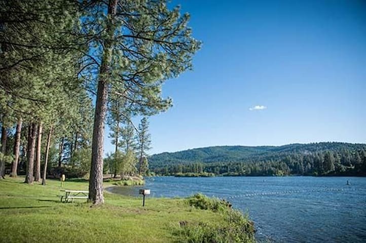
One hour drive from the cabin.
In northeastern Washington, only 25 miles from the U.S.- Canada border, the park is named for 5.5-mile-long Curlew Lake, an angler's dream. A fisher's catch might include trout, bass, yellow perch or tiger muskie. Bald eagles, ospreys and herons also like the fishing at Curlew; they live in the neighboring trees and can be seen flying in to pluck a meal from the lake. A heron rookery with active nests is visible from the park.
Water sports activities abound in summer, and snow sports are popular in winter. The green lawns are tailor-made for play, and the campground, with many lakeside campsites, is said to be one of the most restful in Washington.
PARK FEATURES
Curlew Lake State Park is an 87-acre camping park, 8 miles from the charming gold rush town of Republic.
Discover Pass: A Discover Pass is required for vehicle access to state parks for day useADA AMENITIES/FACILITIES
Campground
Restroom
PICNIC & DAY-USE FACILITIES
There are ten unsheltered picnic tables in the park, available first come, first served. The swimming area has three braziers for cooking.
ACTIVITIES
TRAILS
2 miles of bike trails
2 miles of hiking trails
WATER ACTIVITIES & FEATURES
80 feet of dock
Boating
Fishing (freshwater)
Personal watercraft use
Swimming
Watercraft launches (2)
Waterskiing
WINTER ACTIVITIES & FEATURES
Snow play
OTHER ACTIVITIES & FEATURES
Amphitheater
Bird watching
Wildlife viewing
Curlew Lake State Park Road
Curlew Lake State Park RoadOne hour drive from the cabin.
In northeastern Washington, only 25 miles from the U.S.- Canada border, the park is named for 5.5-mile-long Curlew Lake, an angler's dream. A fisher's catch might include trout, bass, yellow perch or tiger muskie. Bald eagles, ospreys and herons also like the fishing at Curlew; they live in the neighboring trees and can be seen flying in to pluck a meal from the lake. A heron rookery with active nests is visible from the park.
Water sports activities abound in summer, and snow sports are popular in winter. The green lawns are tailor-made for play, and the campground, with many lakeside campsites, is said to be one of the most restful in Washington.
PARK FEATURES
Curlew Lake State Park is an 87-acre camping park, 8 miles from the charming gold rush town of Republic.
Discover Pass: A Discover Pass is required for vehicle access to state parks for day useADA AMENITIES/FACILITIES
Campground
Restroom
PICNIC & DAY-USE FACILITIES
There are ten unsheltered picnic tables in the park, available first come, first served. The swimming area has three braziers for cooking.
ACTIVITIES
TRAILS
2 miles of bike trails
2 miles of hiking trails
WATER ACTIVITIES & FEATURES
80 feet of dock
Boating
Fishing (freshwater)
Personal watercraft use
Swimming
Watercraft launches (2)
Waterskiing
WINTER ACTIVITIES & FEATURES
Snow play
OTHER ACTIVITIES & FEATURES
Amphitheater
Bird watching
Wildlife viewing
20 minute drive from the cabin
Fishing, swimming, boat launch, pit toilet.
Directions: Follow Bench Creek Rd back down to Aeneas Valley Rd, turn right, head south on Aeneas Valley Rd for half of a mile. Turn left (East) onto Long Lake Lane. You will see the public lake access immediately towards the left.
Long Lake Lane
Long Lake Lane20 minute drive from the cabin
Fishing, swimming, boat launch, pit toilet.
Directions: Follow Bench Creek Rd back down to Aeneas Valley Rd, turn right, head south on Aeneas Valley Rd for half of a mile. Turn left (East) onto Long Lake Lane. You will see the public lake access immediately towards the left.
Sightseeing
30 minute drive from the cabin
Elevation: 6,054
Tunk Mountain has just over 2,000 feet of prominence making the Washington Prominence List at #140 of the 144. A fair road reaches to the summit of Tunk, which is also the home to a fire lookout. The first known lookout was a Forest Service lookout point with a 40 foot pole tower with L-4 cab, built in 1933. Remnants of it can be found below the current lookout near the parking area for cars. (61 feet from the summit benchmark as the USGS party in 1936 described). The old tower was torn down in 1966 by the DNR with the DNR funding a new tower to replace it. The current tower is a 40 foot timber tower with DNR live-in cab that was built in 1966, on the highest point. Although the state abandoned it, a private party purchased the tower in 2004 and has a special use permit to leave it on site. Volunteers maintain it and the tower is listed on the National Historic Lookout Register.
Getting There:
There are three ways I know. I drove in from the east on the Peterson Road then Chewiliken Road (FR 200). But driving out, I quickly reached county roads by continuing north then west on Chewilken Road (FR200 & FR 3015). Others have come in on Peony Creek Road (FR3010) from Highway 20. These latter two could probably be driven by most all vehicles
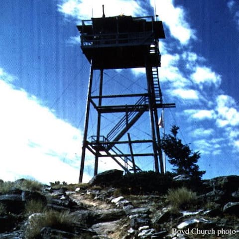
Tunk Mountain
30 minute drive from the cabin
Elevation: 6,054
Tunk Mountain has just over 2,000 feet of prominence making the Washington Prominence List at #140 of the 144. A fair road reaches to the summit of Tunk, which is also the home to a fire lookout. The first known lookout was a Forest Service lookout point with a 40 foot pole tower with L-4 cab, built in 1933. Remnants of it can be found below the current lookout near the parking area for cars. (61 feet from the summit benchmark as the USGS party in 1936 described). The old tower was torn down in 1966 by the DNR with the DNR funding a new tower to replace it. The current tower is a 40 foot timber tower with DNR live-in cab that was built in 1966, on the highest point. Although the state abandoned it, a private party purchased the tower in 2004 and has a special use permit to leave it on site. Volunteers maintain it and the tower is listed on the National Historic Lookout Register.
Getting There:
There are three ways I know. I drove in from the east on the Peterson Road then Chewiliken Road (FR 200). But driving out, I quickly reached county roads by continuing north then west on Chewilken Road (FR200 & FR 3015). Others have come in on Peony Creek Road (FR3010) from Highway 20. These latter two could probably be driven by most all vehicles
45 minute drive from the cabin
There is nothing like the thrill of discovery. Just like pages in a book, fossil impressions are embedded in 50 million years old layers of shale; when the rock splits and there is fossil inside, many squeal with delight at the discovery. That fossil has never seen the light of day and is certainly something that has not been seen before by human eyes. Finding a fossil takes a bit of patience, yet the odds of finding one are excellent.
Before you start your search to discover
Check-in
Everyone in your party must visit the Stonerose Interpretive Center and purchase a site admission sticker. (Fees for hunting fossils at the Boothill Fossil Site). A Stonerose staff member will provide information on how to and where to dig for fossils. Later, they’ll identify the finds and give you a reference sheet with the names of your fossils. You get to keep the three you choose. * In the case where a fossil has never been seen before, paleontologist working at Stonerose will describe, classify and name it. And, when it is published in a scientific journal, the Stonerose digger will be given credit for its discovery!
For returning visitors, Since the site is changing from year to year, you must register at the Stonerose center and receive a refresher orientation.
The latest that digging must begin is 3 pm, as the fossil site closes at 4 pm.
Rules
There are Rules that must be followed for your safety and for the continued scientific research that is important for Stonerose.
Searching for or removing fossils is permitted only after purchasing a site admission sticker at the Stonerose Interpretive Center and only during the hours the Center is open.
All individuals at the fossil site must have an admission sticker with them.
All finds are to be brought to the Center for identification by a Stonerose staff member.
The Stonerose Interpretive Center reserves the right to retain any fossils that are of scientific value, a new discovery, or significant to the Stonerose collection.
Visitors are allowed to take home three fossil pieces per person per day. Commercial use is strictly prohibited.
For safety reasons, do not look for fossils in high areas or as instructed by Stonerose staff.
The fossil site is within walking distance of the Center. There is handicapped parking at the fossil site only. No motor homes, campers or cars with trailers are allowed.
Well behaved dogs are allowed on the site, and in the Center. However, they must be on a leash, no longer than 6 feet. Please provide shade, and water for your furry friend…it can be extremely hot on the site. Paw protection may be necessary on the rock.
Your cooperation is appreciated.
Equipment
Visitors may rent hammers and cold chisels ($7.50 plus tax) for the day from the Center. You may also bring your own small hand tools to use in splitting apart the layers of rock. A medium 1/2-inch-size cold chisel is best, but people have used old screwdrivers or putty knives. A hammer of any kind can be used to tap on the chisel handle. Power tools are not allowed.
Clothing & Protection
We recommend that you wear shoes that offer protection from sharp rocks. Tennis shoes are fine: thongs and sandals are not recommended. We suggest you wear long pants, and bring goggles or sunglasses as protection from flying rock chips and the direct sunlight, and a towel or pad for sitting or kneeling on. We also advise you to bring a hat, and a bottle of water. Water is available for purchase at the site and Center.
Handicapped Accessibility
The Stonerose Interpretive Center is handicapped accessible.
There is also handicapped parking at the fossil site, but, depending on your needs, you may need an assistant to help you access the fossil site.
8 lokal ang nagrerekomenda
Stonerose Interpretive Center & Eocene Fossil Site
15 N Clark Ave45 minute drive from the cabin
There is nothing like the thrill of discovery. Just like pages in a book, fossil impressions are embedded in 50 million years old layers of shale; when the rock splits and there is fossil inside, many squeal with delight at the discovery. That fossil has never seen the light of day and is certainly something that has not been seen before by human eyes. Finding a fossil takes a bit of patience, yet the odds of finding one are excellent.
Before you start your search to discover
Check-in
Everyone in your party must visit the Stonerose Interpretive Center and purchase a site admission sticker. (Fees for hunting fossils at the Boothill Fossil Site). A Stonerose staff member will provide information on how to and where to dig for fossils. Later, they’ll identify the finds and give you a reference sheet with the names of your fossils. You get to keep the three you choose. * In the case where a fossil has never been seen before, paleontologist working at Stonerose will describe, classify and name it. And, when it is published in a scientific journal, the Stonerose digger will be given credit for its discovery!
For returning visitors, Since the site is changing from year to year, you must register at the Stonerose center and receive a refresher orientation.
The latest that digging must begin is 3 pm, as the fossil site closes at 4 pm.
Rules
There are Rules that must be followed for your safety and for the continued scientific research that is important for Stonerose.
Searching for or removing fossils is permitted only after purchasing a site admission sticker at the Stonerose Interpretive Center and only during the hours the Center is open.
All individuals at the fossil site must have an admission sticker with them.
All finds are to be brought to the Center for identification by a Stonerose staff member.
The Stonerose Interpretive Center reserves the right to retain any fossils that are of scientific value, a new discovery, or significant to the Stonerose collection.
Visitors are allowed to take home three fossil pieces per person per day. Commercial use is strictly prohibited.
For safety reasons, do not look for fossils in high areas or as instructed by Stonerose staff.
The fossil site is within walking distance of the Center. There is handicapped parking at the fossil site only. No motor homes, campers or cars with trailers are allowed.
Well behaved dogs are allowed on the site, and in the Center. However, they must be on a leash, no longer than 6 feet. Please provide shade, and water for your furry friend…it can be extremely hot on the site. Paw protection may be necessary on the rock.
Your cooperation is appreciated.
Equipment
Visitors may rent hammers and cold chisels ($7.50 plus tax) for the day from the Center. You may also bring your own small hand tools to use in splitting apart the layers of rock. A medium 1/2-inch-size cold chisel is best, but people have used old screwdrivers or putty knives. A hammer of any kind can be used to tap on the chisel handle. Power tools are not allowed.
Clothing & Protection
We recommend that you wear shoes that offer protection from sharp rocks. Tennis shoes are fine: thongs and sandals are not recommended. We suggest you wear long pants, and bring goggles or sunglasses as protection from flying rock chips and the direct sunlight, and a towel or pad for sitting or kneeling on. We also advise you to bring a hat, and a bottle of water. Water is available for purchase at the site and Center.
Handicapped Accessibility
The Stonerose Interpretive Center is handicapped accessible.
There is also handicapped parking at the fossil site, but, depending on your needs, you may need an assistant to help you access the fossil site.
hiking
One hour drive from the cabin
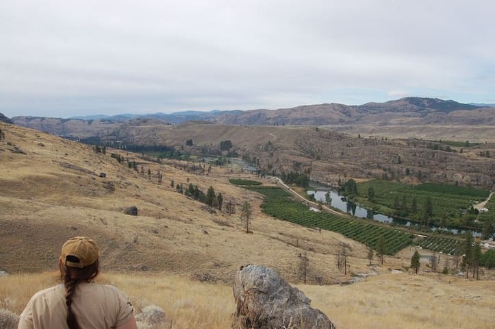
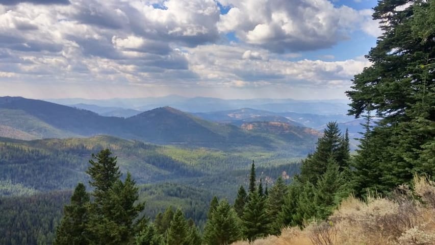
This hike may seem virtually an informality after the arduous drive to its trailhead. However, if fire lookouts intrigue you, and the aesthetic of the rough Okanogan Highlands appeal to you, then this hike is for you. The beauty of the Okanogan may be common knowledge to many. But no matter how many times I visit, I'm amazed each time I delve deeper into its canyons, gorges, and hillsides. Driving the Aeneas Valley Road, outside of Tonasket, is both a step back in time, but also a refreshing reminder of how outstanding the American landscape can be. This bucolic valley is the epitome of rural America.
With reasonable care and a high clearance vehicle you may drive to within 300 yards of the summit, but if you want to hike to it, you can start from the last reasonable road, which makes for an outing with the data listed here: 3.25 miles roundtrip and 600 feet of elevation gain.
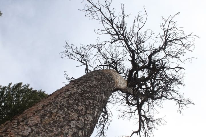
With either approach, your ascent is through a burned-over Ponderosa forest. The recent fire has made for better views from the summit. The forest of course, will heal itself over time.
The hike may be taken one of two ways. If you care to save your vehicle, park at the last, left-hand turn and walk the remaining 1.4 miles of rough forest service road. The views are good at times and the forest is grown in sufficiently to provide decent shade.
If you are interested in braving the drive, the end of the road leaves you just a few hundred yards from the lookout tower. From this approach, the grade is easy as the trail winds through exposed bedrock and second growth forest. The views from the summit are improved since fires thinned the trees recently.
Getting There
Drive east on Highway 20 from Tonasket for 12.7 miles. Turn right onto Aeneas Valley Road. Enjoy this sublime, ranching valley for 16.5 miles before turning left onto Coco Mountain Road. This road climbs steeply eventually turning into FS 3120.
After 3.5 miles (from Aeneas) turn right onto FS 200. After 1.2 miles there is an unsigned road on your left. Either park here and walk or drive the remaining 1.4 miles to the trail head and lookout.
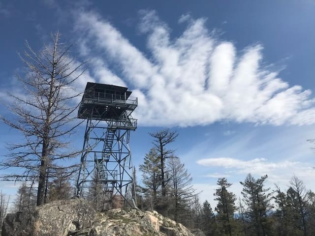
Cornell Butte
One hour drive from the cabin
This hike may seem virtually an informality after the arduous drive to its trailhead. However, if fire lookouts intrigue you, and the aesthetic of the rough Okanogan Highlands appeal to you, then this hike is for you. The beauty of the Okanogan may be common knowledge to many. But no matter how many times I visit, I'm amazed each time I delve deeper into its canyons, gorges, and hillsides. Driving the Aeneas Valley Road, outside of Tonasket, is both a step back in time, but also a refreshing reminder of how outstanding the American landscape can be. This bucolic valley is the epitome of rural America.
With reasonable care and a high clearance vehicle you may drive to within 300 yards of the summit, but if you want to hike to it, you can start from the last reasonable road, which makes for an outing with the data listed here: 3.25 miles roundtrip and 600 feet of elevation gain.
With either approach, your ascent is through a burned-over Ponderosa forest. The recent fire has made for better views from the summit. The forest of course, will heal itself over time.
The hike may be taken one of two ways. If you care to save your vehicle, park at the last, left-hand turn and walk the remaining 1.4 miles of rough forest service road. The views are good at times and the forest is grown in sufficiently to provide decent shade.
If you are interested in braving the drive, the end of the road leaves you just a few hundred yards from the lookout tower. From this approach, the grade is easy as the trail winds through exposed bedrock and second growth forest. The views from the summit are improved since fires thinned the trees recently.
Getting There
Drive east on Highway 20 from Tonasket for 12.7 miles. Turn right onto Aeneas Valley Road. Enjoy this sublime, ranching valley for 16.5 miles before turning left onto Coco Mountain Road. This road climbs steeply eventually turning into FS 3120.
After 3.5 miles (from Aeneas) turn right onto FS 200. After 1.2 miles there is an unsigned road on your left. Either park here and walk or drive the remaining 1.4 miles to the trail head and lookout.

Swan Lake
Little over an hour drive from the cabin.
Three mile round trip hike around Swan Lake.
45 minute drive from the cabin
4.2 miles round trip
This trail starts from the campground on Bonaparte Lake, and winds up to rock cliffs over looking the lake.
Begin on a carpet mat of needles from pine trees, and then enjoy views of more massive larch and huge Ponderosa pines! Many flower species make up the carpet of flora along the trail, which continues up the ridge and through meadows.
Be alert - moose have been spotted here and they can be temperamental.
Getting There
From Tonasket: Take State Route 20 for about 20 miles and turn left on Lake Bonaparte Road. Stay on this road for about 6 miles, until you arrive at the Bonaparte Lake Campground. The trail begins just past the campground.
Bonaparte Lake Campground
615 Bonaparte Lake Road45 minute drive from the cabin
4.2 miles round trip
This trail starts from the campground on Bonaparte Lake, and winds up to rock cliffs over looking the lake.
Begin on a carpet mat of needles from pine trees, and then enjoy views of more massive larch and huge Ponderosa pines! Many flower species make up the carpet of flora along the trail, which continues up the ridge and through meadows.
Be alert - moose have been spotted here and they can be temperamental.
Getting There
From Tonasket: Take State Route 20 for about 20 miles and turn left on Lake Bonaparte Road. Stay on this road for about 6 miles, until you arrive at the Bonaparte Lake Campground. The trail begins just past the campground.
45 minute drive from the cabin
The McLaughlin Canyon Trail is a part of the Brigade Trail used by the Hudson's Bay Company in the early 1800's and became known as the Caribou Trail during the Gold Rush in the 1850's. Today it is an easy 3 mile round trip. There was a wildfire here in 2007, but wildflowers are just starting to take hold in this area, which makes it worth the trip in spring and summer.
Back in the 1850s, these trails diverged from the Okanogan River as the shoreline was impassable and climbed into the confined canyon. This became the perfect ambush site. On July 29, 1858, Native Americans from the Chelan, Okanogan, and Columbia tribes ambushed a group of approximately 160 prospectors in McLoughlin Canyon. Six of the travelers are killed, about nine others are wounded, and several Indians may have been killed. The miners withdrew crossed the river and continued their journey amid sniping and theft of stock, but no one else will be killed.
Today, the trail descends the canyon and overlooks the Okanogan River. Even with a wildfire so recent, it is interesting and beautiful to see life returning to the canyon. One note: watch for blowdowns
.Getting There
Four miles south of Tonasket WA, take McLaughlin Canyon Rd for three miles to trailhead on north side of road. Trail is on the south side of road.
McLaughlin Canyon Trail
McLaughlin Canyon Trail45 minute drive from the cabin
The McLaughlin Canyon Trail is a part of the Brigade Trail used by the Hudson's Bay Company in the early 1800's and became known as the Caribou Trail during the Gold Rush in the 1850's. Today it is an easy 3 mile round trip. There was a wildfire here in 2007, but wildflowers are just starting to take hold in this area, which makes it worth the trip in spring and summer.
Back in the 1850s, these trails diverged from the Okanogan River as the shoreline was impassable and climbed into the confined canyon. This became the perfect ambush site. On July 29, 1858, Native Americans from the Chelan, Okanogan, and Columbia tribes ambushed a group of approximately 160 prospectors in McLoughlin Canyon. Six of the travelers are killed, about nine others are wounded, and several Indians may have been killed. The miners withdrew crossed the river and continued their journey amid sniping and theft of stock, but no one else will be killed.
Today, the trail descends the canyon and overlooks the Okanogan River. Even with a wildfire so recent, it is interesting and beautiful to see life returning to the canyon. One note: watch for blowdowns
.Getting There
Four miles south of Tonasket WA, take McLaughlin Canyon Rd for three miles to trailhead on north side of road. Trail is on the south side of road.
One hour and thirty minute drive from the cabin
One of the most popular hikes on the Colville National Forest is the short but challenging hike to the summit of Columbia Mountain, where vistas of surrounding mountains, wildflowers and one of the oldest fire lookouts in the state await you.
The trail wraps around the base of Columbia Mountain, passing through pine forest, aspen groves and even a section of aromatic sagebrush. A variant of the hike will take you around a loop trail around the summit of the mountain. There is water available at springs at approximately 2 miles into the hike, but bring a filter as the springs are used by cattle.
Camping is available at both the trailhead and at the summit. The lookout has been restored and is open to the public for camping, but no fires or cook stoves are allowed inside or near the structure.
The summit stands at 6,760 feet and has great views to the south and west. Wildflowers abound in the summit meadow in the spring and summer.
Getting There
From Republic, take Highway 20 eastbound over Sherman Pass. Proceed 4.2 miles east of the Pass, then turn left (north) on Albion Hill Road.
From the east: Immediately after crossing the Columbia River bridge just west of Kettle Falls, take Highway 20 westbound. At approximately 18 miles, turn right (north) on Albion Hill Road.
Columbia Mountain
One hour and thirty minute drive from the cabin
One of the most popular hikes on the Colville National Forest is the short but challenging hike to the summit of Columbia Mountain, where vistas of surrounding mountains, wildflowers and one of the oldest fire lookouts in the state await you.
The trail wraps around the base of Columbia Mountain, passing through pine forest, aspen groves and even a section of aromatic sagebrush. A variant of the hike will take you around a loop trail around the summit of the mountain. There is water available at springs at approximately 2 miles into the hike, but bring a filter as the springs are used by cattle.
Camping is available at both the trailhead and at the summit. The lookout has been restored and is open to the public for camping, but no fires or cook stoves are allowed inside or near the structure.
The summit stands at 6,760 feet and has great views to the south and west. Wildflowers abound in the summit meadow in the spring and summer.
Getting There
From Republic, take Highway 20 eastbound over Sherman Pass. Proceed 4.2 miles east of the Pass, then turn left (north) on Albion Hill Road.
From the east: Immediately after crossing the Columbia River bridge just west of Kettle Falls, take Highway 20 westbound. At approximately 18 miles, turn right (north) on Albion Hill Road.
40 minute drive from the cabin
Sweat Creek Basin Trail 310-A is accessible just off the pavement of Highway 20 at the Sweat Creek Picnic Area. The site of a former campground, most of the amenities have since been removed, although a CXT toilet remains.
Begin the hike by proceeding past the CXT toilet. There is no signage to indicate the trail from the parking lot, but the trail is easily visible proceeding behind the bathrooms. After a short distance the trail passes through a hiker turnstile adjacent to a cattle fence. If choosing to use the fence gate instead of the turnstile (a tight fit for big backpacks!) be sure to close the gate after passing through, as this area does have an active grazing allotment in the summer.
Immediately after crossing the fence the trail reaches a junction with Clackamas Mountain Trail crossing Sweat Creek and heading west. Instead turn east to continue on the Sweat Creek Basin Trail. The trail climbs quickly and steadily, passing beneath the powerlines in the early portion of the hike. The views get better and better along the way as the trail meanders beneath large old growth Ponderosa pine, Douglas fir, and western larch. This trail is spectacular in the spring as the wildflowers begin to bloom, and also in the fall as the western larch turn yellow and drop their needles.
At approximately the 4.5 mile mark the trail comes to Hunter Spring, the first access to water. There is both a cistern and a cattle trough, along with a large campsite at this location. Exercise caution if choosing to camp here, as there are many standing dead Douglas fir trees in the immediate vicinity of the campsite.
From Hunter Spring there is an unmarked trail junction leading to Maple Mountain to the east, but the main Sweat Creek Basin Trail continues to ascend northwest out of the camp area. In approximately 1.5 miles the trail reaches Pass Spring, with another campsite at this location. At approximately the 6.5 mile mark Sweat Creek Basin intersects Clackamas Mountain Trail to the west, and West Fork Trail continuing north.
Sweat Creek Basin is also a portion of the Pacific Northwest Trail, which continues along West Fork Trail
.Getting There
Sweat Creek Picnic Area and the beginning the Sweat Creek Basin Trail is located on the north side of Highway 20. It is 8.5 miles west of Republic, and 31 miles east of Tonasket.
Sweat Creek Picnic Area
40 minute drive from the cabin
Sweat Creek Basin Trail 310-A is accessible just off the pavement of Highway 20 at the Sweat Creek Picnic Area. The site of a former campground, most of the amenities have since been removed, although a CXT toilet remains.
Begin the hike by proceeding past the CXT toilet. There is no signage to indicate the trail from the parking lot, but the trail is easily visible proceeding behind the bathrooms. After a short distance the trail passes through a hiker turnstile adjacent to a cattle fence. If choosing to use the fence gate instead of the turnstile (a tight fit for big backpacks!) be sure to close the gate after passing through, as this area does have an active grazing allotment in the summer.
Immediately after crossing the fence the trail reaches a junction with Clackamas Mountain Trail crossing Sweat Creek and heading west. Instead turn east to continue on the Sweat Creek Basin Trail. The trail climbs quickly and steadily, passing beneath the powerlines in the early portion of the hike. The views get better and better along the way as the trail meanders beneath large old growth Ponderosa pine, Douglas fir, and western larch. This trail is spectacular in the spring as the wildflowers begin to bloom, and also in the fall as the western larch turn yellow and drop their needles.
At approximately the 4.5 mile mark the trail comes to Hunter Spring, the first access to water. There is both a cistern and a cattle trough, along with a large campsite at this location. Exercise caution if choosing to camp here, as there are many standing dead Douglas fir trees in the immediate vicinity of the campsite.
From Hunter Spring there is an unmarked trail junction leading to Maple Mountain to the east, but the main Sweat Creek Basin Trail continues to ascend northwest out of the camp area. In approximately 1.5 miles the trail reaches Pass Spring, with another campsite at this location. At approximately the 6.5 mile mark Sweat Creek Basin intersects Clackamas Mountain Trail to the west, and West Fork Trail continuing north.
Sweat Creek Basin is also a portion of the Pacific Northwest Trail, which continues along West Fork Trail
.Getting There
Sweat Creek Picnic Area and the beginning the Sweat Creek Basin Trail is located on the north side of Highway 20. It is 8.5 miles west of Republic, and 31 miles east of Tonasket.
One hour drive from the cabin
The trail on Fir Mountain can be hard to follow at times, but persistent route-finders are rewarded with a 2 mile, steep trail through open pine forest to views from a former fire lookout site.
In late summer, berries for snacking along the way abound, and green wet areas full of flowers make for gorgeous photos. If you're watchful, you may be rewarded with some glimpses of wildlife, too.
In winter, the hike is a steep march through forest and quiet drifts of snow. The hardest part about the winter route may be finding enough room to park the car, but as a last resort, use the Sweat Creek parking lot, only a short walk across Highway 20 from the trailhead.
The winter trail immediately begins its steady march up the steep slope. While the initial forest is second-growth and largely uninteresting, it doesn't take long for the trees to open up and the views to improve. At the same time, it's easy to see that this trail is a wildlife haven, as evidenced by the numerous tracks crisscrossing the trail.
Watch for sawed trees, the tell-tale sign of the correct trail corridor, so as not to be led astray by the game trails. At the windswept summit, former site of a lookout tower, the views are fantastic in all directions. Return via the same route
Getting There
The parking lot for this hike is near the Sweat Creek Picnic Area.
From Spokane, take Highway 395 north through Colville and Kettle Falls. Cross the bridge over the Columbia, then turn left on Highway 20. Continue over Sherman Pass through Republic, remaining on Highway 20. Approximately 8 miles beyond Republic, turn left on FS 31 across the road from the Sweat Creek Picnic Area. The TH is on the right in approximately a half mile; limited parking on the left.
There is a post on your right marking the start of the trail. There may be some parking nearer to the trail, but the road isn't the widest and plenty of firewood laden pickups come roaring down this road, so shoulder park at your own risk.
Fir Mountain
One hour drive from the cabin
The trail on Fir Mountain can be hard to follow at times, but persistent route-finders are rewarded with a 2 mile, steep trail through open pine forest to views from a former fire lookout site.
In late summer, berries for snacking along the way abound, and green wet areas full of flowers make for gorgeous photos. If you're watchful, you may be rewarded with some glimpses of wildlife, too.
In winter, the hike is a steep march through forest and quiet drifts of snow. The hardest part about the winter route may be finding enough room to park the car, but as a last resort, use the Sweat Creek parking lot, only a short walk across Highway 20 from the trailhead.
The winter trail immediately begins its steady march up the steep slope. While the initial forest is second-growth and largely uninteresting, it doesn't take long for the trees to open up and the views to improve. At the same time, it's easy to see that this trail is a wildlife haven, as evidenced by the numerous tracks crisscrossing the trail.
Watch for sawed trees, the tell-tale sign of the correct trail corridor, so as not to be led astray by the game trails. At the windswept summit, former site of a lookout tower, the views are fantastic in all directions. Return via the same route
Getting There
The parking lot for this hike is near the Sweat Creek Picnic Area.
From Spokane, take Highway 395 north through Colville and Kettle Falls. Cross the bridge over the Columbia, then turn left on Highway 20. Continue over Sherman Pass through Republic, remaining on Highway 20. Approximately 8 miles beyond Republic, turn left on FS 31 across the road from the Sweat Creek Picnic Area. The TH is on the right in approximately a half mile; limited parking on the left.
There is a post on your right marking the start of the trail. There may be some parking nearer to the trail, but the road isn't the widest and plenty of firewood laden pickups come roaring down this road, so shoulder park at your own risk.
One hour drive from the cabin
The short trail at Curlew Lake State Park is a nice way to spend some time exploring the area that is primarily popular with fishermen.
Nestled in the rolling hills outside the small town of Republic, this little park is a popular place to come camp, fish and enjoy the surrounding landscape. The short nature trail here offers something for restless legs to do, but its quite short
Getting There
From Republic, drive Highway 21 north for eight miles to the intersection with State Park Road. Turn left into the park.
Curlew Lake State Park Road
Curlew Lake State Park RoadOne hour drive from the cabin
The short trail at Curlew Lake State Park is a nice way to spend some time exploring the area that is primarily popular with fishermen.
Nestled in the rolling hills outside the small town of Republic, this little park is a popular place to come camp, fish and enjoy the surrounding landscape. The short nature trail here offers something for restless legs to do, but its quite short
Getting There
From Republic, drive Highway 21 north for eight miles to the intersection with State Park Road. Turn left into the park.
One hour drive from the cabin
This lakeside trail begins in Beaver Lake Campground and travels 1.9 flat miles to Beth Lake, offering opportunities to view fish and waterfowl including the Common Loon.
From the trailhead near campsite 4 in the Beaver Lake campground, look for a sign about 40 feet off the road, near a small stream.
From the sign, take off on a trail contouring the hillside just above Beaver Lake. Continuing on to the left, you'll pass along the back side of the lake, then pass through Beth Lake Campground.
Continuing on, arrive at a small earthen dam near the north end boat launch. Cross the dam and follow the trail around to the far side of Beth Lake
Getting There
From Tonasket, drive east on Highway 20 for 24 miles to County Road 4953 (Bonaparte Recreation Area). Take County Road 4953 for 5.5 miles, to where it turns into Forest Service Road 32.
Continue on Forest Service Road 32 for 7 miles to Beaver Lake Campground. Turn into Beaver Lake Campground, and head for the day use parking near Campsite #4. The trail departs here.
Beaver Lake Campground
Bonaparte Lake RoadOne hour drive from the cabin
This lakeside trail begins in Beaver Lake Campground and travels 1.9 flat miles to Beth Lake, offering opportunities to view fish and waterfowl including the Common Loon.
From the trailhead near campsite 4 in the Beaver Lake campground, look for a sign about 40 feet off the road, near a small stream.
From the sign, take off on a trail contouring the hillside just above Beaver Lake. Continuing on to the left, you'll pass along the back side of the lake, then pass through Beth Lake Campground.
Continuing on, arrive at a small earthen dam near the north end boat launch. Cross the dam and follow the trail around to the far side of Beth Lake
Getting There
From Tonasket, drive east on Highway 20 for 24 miles to County Road 4953 (Bonaparte Recreation Area). Take County Road 4953 for 5.5 miles, to where it turns into Forest Service Road 32.
Continue on Forest Service Road 32 for 7 miles to Beaver Lake Campground. Turn into Beaver Lake Campground, and head for the day use parking near Campsite #4. The trail departs here.
laundry/showers
45 minute drive from the cabin
Washers, dryers, and coin showers. Open 7am - 9pm seven days a week.
The Junction Laundromat
509 N Whitcomb Ave45 minute drive from the cabin
Washers, dryers, and coin showers. Open 7am - 9pm seven days a week.
One hour drive from the cabin.
Washers, dryers, and showers. Open 7am - 7pm seven days a week.
The Scrub Board
45 North Keller StreetOne hour drive from the cabin.
Washers, dryers, and showers. Open 7am - 7pm seven days a week.