
Caron Cabin Guidebook
Food scene

Two Rivers Lunch
75 Dickey RoadDelicious Home Cooked Food just a few miles from camp!
Canoeing, Kayaking, Sightseeing, Fishing
Allagash Wilderness Waterway -
The most stunning wild waterway preserved in a forever natural state.
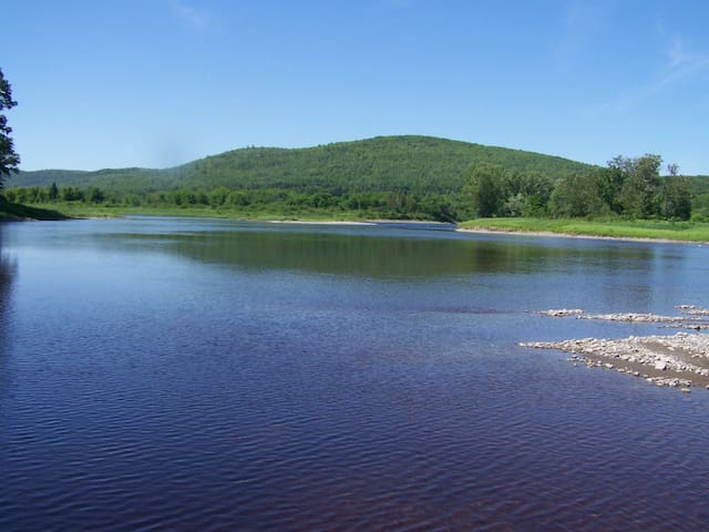
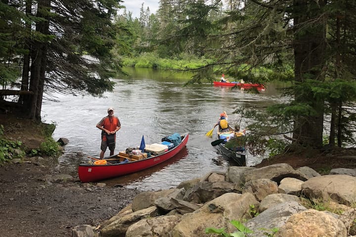
The Allagash River and the lakes and ponds that join it were once a distant, commercial highway through the faraway heart of Maine’s northwestern forest. Lumbermen cut and floated countless logs down its waters to market. Today, the Allagash carries something else: canoeists and kayakers traveling the farthest reaches of the North Maine Woods seeking solitude and adventure.
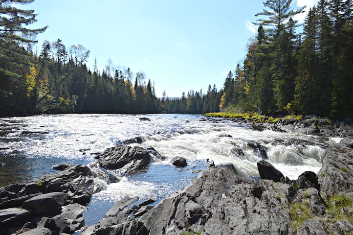
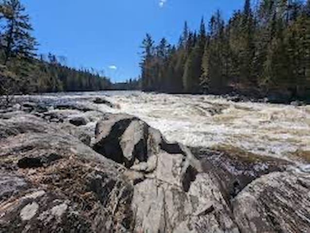
The Allagash Wilderness Waterway, established by the State of Maine and part of the National Wild and Scenic River System, is 92 miles long and a classic of Eastern paddling. Boaters can take the entire route and spend more than a week on the water. Or, they can take shorter, multi-day trips. However long the journey, paddlers traverse broad, beautiful (and sometimes windy) lakes along with river sections that burble slowly or chatter with Class II whitewater.
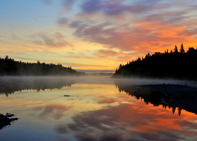
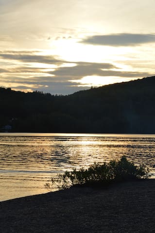
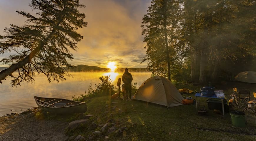
Sunset over Round Pond, Allagash, Maine. – Joel Sanford
A Waterway So Untouched
Besides the splendid boating, the Allagash offers some prime Maine fishing habitats. Either from the boat or the shore, anglers can hook wild native brook trout, lake trout and lake whitefish. And in winter, the Allagash is prime country for ice fishing and for the snowmobiles that bring the anglers to the fishing spots.
The river, lakes, ponds and streams that make up the Waterway are still surrounded by working commercial forest; if you come, you’ll drive to the river on logging roads. But the Waterway was designed to shield paddlers from the outside world. Signs of current civilization are few. Campgrounds along the water are plentiful but offer few amenities. You’ll get tent spaces, poles for tarps, an outhouse and a picnic table or two. This is backcountry camping. Moose outnumber working cellphones.
A journey north on the Allagash is also a journey through the past. Old logging and lumber equipment is scattered throughout the trees. Included in that rusting gear is a tramway that once dragged logs through the forest and two locomotives, resting where they were left, from the defunct Eagle Lake & West Branch Railroad, which hauled hundreds of thousands of cords of wood.
Running the Allagash is a lifetime ambition for many paddlers. It can be a daunting one. Good planning is vital, since travelers need to bring everything they need for the journey. There’re no Walmarts on the banks of the Allagash.
Because of its challenges and remote character, the Allagash is probably best enjoyed by experienced paddlers – if they’re going by themselves. Neophytes can enjoy it on guided trips. On such journeys, planning and logistical issues are solved by the guides, who also lead the trips. Check out companies such as Allagash Canoe Trips, Allagash Guide Service, Canoe the Wild, and Northwoods Outfitters.
TAKEN FROM: VISTMAINE
Allagash Wilderness Waterway
Allagash Wilderness Waterway -
The most stunning wild waterway preserved in a forever natural state.
The Allagash River and the lakes and ponds that join it were once a distant, commercial highway through the faraway heart of Maine’s northwestern forest. Lumbermen cut and floated countless logs down its waters to market. Today, the Allagash carries something else: canoeists and kayakers traveling the farthest reaches of the North Maine Woods seeking solitude and adventure.
The Allagash Wilderness Waterway, established by the State of Maine and part of the National Wild and Scenic River System, is 92 miles long and a classic of Eastern paddling. Boaters can take the entire route and spend more than a week on the water. Or, they can take shorter, multi-day trips. However long the journey, paddlers traverse broad, beautiful (and sometimes windy) lakes along with river sections that burble slowly or chatter with Class II whitewater.
Sunset over Round Pond, Allagash, Maine. – Joel Sanford
A Waterway So Untouched
Besides the splendid boating, the Allagash offers some prime Maine fishing habitats. Either from the boat or the shore, anglers can hook wild native brook trout, lake trout and lake whitefish. And in winter, the Allagash is prime country for ice fishing and for the snowmobiles that bring the anglers to the fishing spots.
The river, lakes, ponds and streams that make up the Waterway are still surrounded by working commercial forest; if you come, you’ll drive to the river on logging roads. But the Waterway was designed to shield paddlers from the outside world. Signs of current civilization are few. Campgrounds along the water are plentiful but offer few amenities. You’ll get tent spaces, poles for tarps, an outhouse and a picnic table or two. This is backcountry camping. Moose outnumber working cellphones.
A journey north on the Allagash is also a journey through the past. Old logging and lumber equipment is scattered throughout the trees. Included in that rusting gear is a tramway that once dragged logs through the forest and two locomotives, resting where they were left, from the defunct Eagle Lake & West Branch Railroad, which hauled hundreds of thousands of cords of wood.
Running the Allagash is a lifetime ambition for many paddlers. It can be a daunting one. Good planning is vital, since travelers need to bring everything they need for the journey. There’re no Walmarts on the banks of the Allagash.
Because of its challenges and remote character, the Allagash is probably best enjoyed by experienced paddlers – if they’re going by themselves. Neophytes can enjoy it on guided trips. On such journeys, planning and logistical issues are solved by the guides, who also lead the trips. Check out companies such as Allagash Canoe Trips, Allagash Guide Service, Canoe the Wild, and Northwoods Outfitters.
TAKEN FROM: VISTMAINE
Little Black River
Saint John River
Fish River Falls
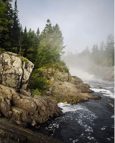
Allagash Falls
Eagle Lake
Hiking, Climbing, Camping
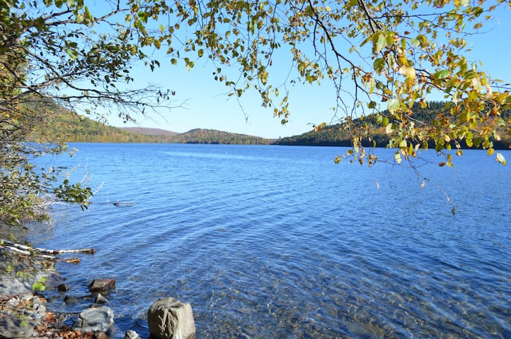
Deboullie Public Lands offer remote campsites on crystal-clear trout ponds surrounded by low rugged mountains. These lands, encompassing 17 ponds ranging in size from 8 to 341 acres, lie in northernmost Maine, east of the Allagash Wilderness Waterway and 30 miles from the Canadian border. The name Deboullie is an adaptation of the French word, débouler, which means to tumble down—referring to the talus fields (former rock slides) at the base of several mountains.
A 12-mile trail network with several loop options leads to many remote ponds and to Deboullie Mountain (1,981 feet) where a former fire tower offers expansive views of the surrounding region. Hikers can enjoy mountaintop blueberries in August and find “ice caves” – narrow, shaded crevices where snow and ice can remain year-round, supporting unusual plants such as the arctic sandwort.
Deboullie Mountain Trail (4 miles round-trip, allow 4 hours): The Deboullie Mountain Trail begins by a parking area at the east end of Deboullie Pond. The trail follows the pond shore west for 1.3 miles and crosses a large rock-slide before entering a clearing with a picnic site—where a side trail heads steeply up for six-tenths of a mile to the summit with views in all directions from the 48-foot fire tower. Look for ice caves along the way.
Deboullie Loop Trail (6 miles round-trip, allow 4 hours): The Deboullie Loop Trail begins at the east end of Deboullie Pond and follows the pond shore west 1.3 miles, passing the summit trail, and continuing west 0.8 miles to the end of the pond. The trail turns south, with a short spur leading to scenic Gardner Pond. The trail then forks. The right-hand (western) fork heads 1.4 miles to Denny Pond via the Denny Trail. Continue left (east), going 2.7 miles though woods to the shore of Pushineer Pond. The hiking loop route continues from the junction with a gravel road heading back to the original trailhead. The walk to the trailhead north along the gravel road is approximately one-mile in distance.
Black Mountain Loop Tail (5.5 miles round-trip, allow 4 hours): The Black Mountain Loop Trail begins at the east end of Deboullie Pond. Follow the Little Black Ponds Trail to Black Pond, then the right-hand (eastern) trail to Black Mountain. The scenic vista on Black Mountain provides spectacular views of Black Pond and the surrounding forest. The trail continues along the top of Black Mountain, across the saddle of Deboullie Mountain and Black Mountain then up the north side of Deboullie Mountain to the tower. Follow the Deboullie Mountain Trail back to the trail head parking via the trail segment along the northern shore of Deboullie Pond.
OTHER INFORMATION
Deboullie Public Lands lie within the North Maine Woods recreational system: visitors must pass through a checkpoint and pay the required day use or camping fees. The State of Maine is a member of North Maine Woods, an organization that manages recreation on nearly three million acres in Northern Maine. Fees collected at checkpoints defray the costs of managing gate systems and maintaining recreational facilities.
The area has a reputation for outstanding fisheries, with native brook trout in many ponds and landlocked salmon and lake trout in Togue Pond. Several ponds have populations of blueback trout (landlocked arctic charr), an unusual variety that is the world’s northernmost freshwater fish. Hiking trails provide shoreline access to numerous fishing destinations.
Take care traveling along area logging roads, pulling over and stopping for trucks regardless of which direction they’re headed. Do not block side roads and never stop where visibility is poor. Roads can be dusty in dry weather and washed out in wet weather. Gravel roads are hard on tires (and suspension systems): travel slowly and carry a spare tire.
Don't count on your cell phone in an emergency as coverage is spotty to non-existent.
TAKEN FROM: https://www.mainetrailfinder.com/trails/trail/deboullie-public-reserved-land
Deboullie Mountain
Deboullie Public Lands offer remote campsites on crystal-clear trout ponds surrounded by low rugged mountains. These lands, encompassing 17 ponds ranging in size from 8 to 341 acres, lie in northernmost Maine, east of the Allagash Wilderness Waterway and 30 miles from the Canadian border. The name Deboullie is an adaptation of the French word, débouler, which means to tumble down—referring to the talus fields (former rock slides) at the base of several mountains.
A 12-mile trail network with several loop options leads to many remote ponds and to Deboullie Mountain (1,981 feet) where a former fire tower offers expansive views of the surrounding region. Hikers can enjoy mountaintop blueberries in August and find “ice caves” – narrow, shaded crevices where snow and ice can remain year-round, supporting unusual plants such as the arctic sandwort.
Deboullie Mountain Trail (4 miles round-trip, allow 4 hours): The Deboullie Mountain Trail begins by a parking area at the east end of Deboullie Pond. The trail follows the pond shore west for 1.3 miles and crosses a large rock-slide before entering a clearing with a picnic site—where a side trail heads steeply up for six-tenths of a mile to the summit with views in all directions from the 48-foot fire tower. Look for ice caves along the way.
Deboullie Loop Trail (6 miles round-trip, allow 4 hours): The Deboullie Loop Trail begins at the east end of Deboullie Pond and follows the pond shore west 1.3 miles, passing the summit trail, and continuing west 0.8 miles to the end of the pond. The trail turns south, with a short spur leading to scenic Gardner Pond. The trail then forks. The right-hand (western) fork heads 1.4 miles to Denny Pond via the Denny Trail. Continue left (east), going 2.7 miles though woods to the shore of Pushineer Pond. The hiking loop route continues from the junction with a gravel road heading back to the original trailhead. The walk to the trailhead north along the gravel road is approximately one-mile in distance.
Black Mountain Loop Tail (5.5 miles round-trip, allow 4 hours): The Black Mountain Loop Trail begins at the east end of Deboullie Pond. Follow the Little Black Ponds Trail to Black Pond, then the right-hand (eastern) trail to Black Mountain. The scenic vista on Black Mountain provides spectacular views of Black Pond and the surrounding forest. The trail continues along the top of Black Mountain, across the saddle of Deboullie Mountain and Black Mountain then up the north side of Deboullie Mountain to the tower. Follow the Deboullie Mountain Trail back to the trail head parking via the trail segment along the northern shore of Deboullie Pond.
OTHER INFORMATION
Deboullie Public Lands lie within the North Maine Woods recreational system: visitors must pass through a checkpoint and pay the required day use or camping fees. The State of Maine is a member of North Maine Woods, an organization that manages recreation on nearly three million acres in Northern Maine. Fees collected at checkpoints defray the costs of managing gate systems and maintaining recreational facilities.
The area has a reputation for outstanding fisheries, with native brook trout in many ponds and landlocked salmon and lake trout in Togue Pond. Several ponds have populations of blueback trout (landlocked arctic charr), an unusual variety that is the world’s northernmost freshwater fish. Hiking trails provide shoreline access to numerous fishing destinations.
Take care traveling along area logging roads, pulling over and stopping for trucks regardless of which direction they’re headed. Do not block side roads and never stop where visibility is poor. Roads can be dusty in dry weather and washed out in wet weather. Gravel roads are hard on tires (and suspension systems): travel slowly and carry a spare tire.
Don't count on your cell phone in an emergency as coverage is spotty to non-existent.
TAKEN FROM: https://www.mainetrailfinder.com/trails/trail/deboullie-public-reserved-land
Fish River Falls, Fort Kent, ME 04743, Estados Unidos
Resturants, Bars & More
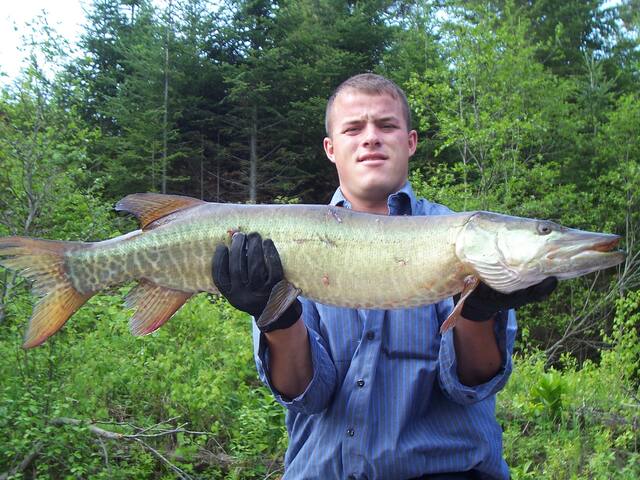
Fort Kent is located 45 minutes from camp. Here is the home of a gateway into Canada, America's First Mile, the annual International Muskie Fishing Derby, Ploye Festival & CanAm Dog Sled Races, The University of Maine at Fort Kent, several resturants, a brewery and grocery stores, a ski resort - Lonesome Pine Trails, The Outdoor center, as well as historic sites & so much more.
https://www.fortkentoc.org/
https://www.lonesomepines.org/
https://www.cbp.gov/contact/ports/fort-kent-maine-0110
https://fortkentchamber.com/member/swamp-buck/
https://www.facebook.com/mooseshackll/
https://www.nps.gov/maac/planyourvisit/blockhouse.htm
http://www.fortkent-muskie.com/
https://can-am-crown.net/home.php
https://www.facebook.com/PloyeFest/
https://www.atlasobscura.com/places/americas-first-mile
https://m.facebook.com/JDs-Tavern-105434715222682/?_rdr
https://www.firstmilebrewing.com/
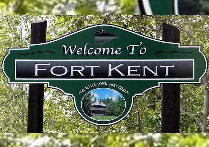
Fort Kent
Fort Kent is located 45 minutes from camp. Here is the home of a gateway into Canada, America's First Mile, the annual International Muskie Fishing Derby, Ploye Festival & CanAm Dog Sled Races, The University of Maine at Fort Kent, several resturants, a brewery and grocery stores, a ski resort - Lonesome Pine Trails, The Outdoor center, as well as historic sites & so much more.
https://www.fortkentoc.org/
https://www.lonesomepines.org/
https://www.cbp.gov/contact/ports/fort-kent-maine-0110
https://fortkentchamber.com/member/swamp-buck/
https://www.facebook.com/mooseshackll/
https://www.nps.gov/maac/planyourvisit/blockhouse.htm
http://www.fortkent-muskie.com/
https://can-am-crown.net/home.php
https://www.facebook.com/PloyeFest/
https://www.atlasobscura.com/places/americas-first-mile
https://m.facebook.com/JDs-Tavern-105434715222682/?_rdr
https://www.firstmilebrewing.com/

Swamp Buck Restaurant & Lounge
250 W Main StLocated in Fort Kent, this restaurant is one of the best around.
These burgers can’t be beat! Poutine or as locals call it, Mixed Fries are an absolute must try. Don’t forget to grab a few of Rocks world famous whoopie pies! Yum!
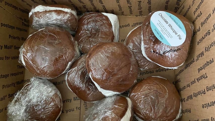
Rock's Family Diner
378 West Main StreetThese burgers can’t be beat! Poutine or as locals call it, Mixed Fries are an absolute must try. Don’t forget to grab a few of Rocks world famous whoopie pies! Yum!
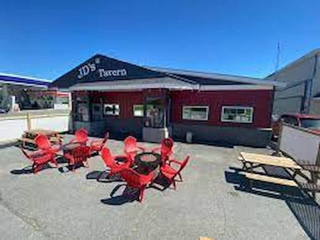
JD's Tavern
328 West Main StreetFirst Mile Brewing Company
28 Market St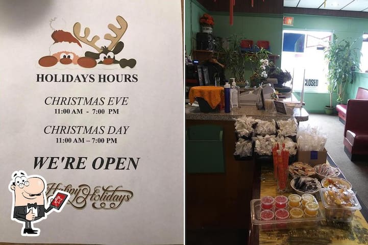
China Garden Restaurant 中國花園
229 West Main Street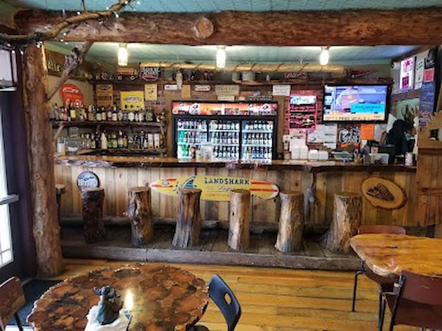
Mooseshack II
76 East Main Street
Whistle Stop
26 Market StreetLakeview Restaurant
9 Lakeview Dr
Barry's Kitchen
178 West Main Street
Forget Me Not Diner
1029 Main Street
McDonald's
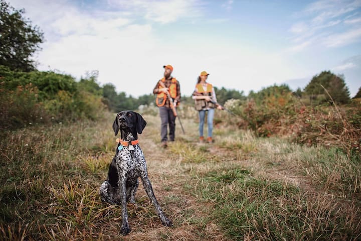
77 East Main StreetHunting, Fishing, Camping, Hiking, Travel, Sightseeing, Canoeing, Kayaking, Outdoor Adventures
Allagash Canoe Trips
166 Scammon Roadhttps://www.allagashcanoetrips.com/canoe-trip-information/meet-our-trip-guides/
Canoe the Wild
588 U.S. 1https://canoethewild.com/allagash-river-canoe-trips/
The North Maine Woods is a multiple landowner, multiple use management area. The private forest landowners and state governmental agencies cooperating together in this program. It is designed to help you have a safe and pleasant trip in the area, plus provide you with valuable information on forest resource management and recreational use.
The area provides numerous outdoor recreational opportunities for over 100,000 visitors each year while at the same time providing renewable forest resources which are a major part of Maine's economy. Harvesting wood products and providing recreation are compatible if managed properly. Providing proper management of day use and camping is the main goal of the North Maine Woods organization.
North Maine Woods
92 Main StThe North Maine Woods is a multiple landowner, multiple use management area. The private forest landowners and state governmental agencies cooperating together in this program. It is designed to help you have a safe and pleasant trip in the area, plus provide you with valuable information on forest resource management and recreational use.
The area provides numerous outdoor recreational opportunities for over 100,000 visitors each year while at the same time providing renewable forest resources which are a major part of Maine's economy. Harvesting wood products and providing recreation are compatible if managed properly. Providing proper management of day use and camping is the main goal of the North Maine Woods organization.
Guide Service
Allagash Guide Service is the regions premier hunting and canoe outfitter, we have been in business for over 35 years. Focusing on quality wilderness experiences, we strive to provide each customer with comfortable and quality lodging, fresh home cooked meals and renowned northern Maine hospitality.
Unlike other Maine hunting outfitters, Allagash Guide Service is locally owned and operated, providing service year round. To learn more about how we can give you the vacation of your dreams, Contact Us Today!
https://www.allagashguideservice.com/
Allagash Guide Service
928 Allagash RoadAllagash Guide Service is the regions premier hunting and canoe outfitter, we have been in business for over 35 years. Focusing on quality wilderness experiences, we strive to provide each customer with comfortable and quality lodging, fresh home cooked meals and renowned northern Maine hospitality.
Unlike other Maine hunting outfitters, Allagash Guide Service is locally owned and operated, providing service year round. To learn more about how we can give you the vacation of your dreams, Contact Us Today!
https://www.allagashguideservice.com/
Located at the confluence of the Allagash and St John Rivers in northern Maine is the small community of Allagash.
Tylor Kelly Camps is a third generation business, offering black bear hunting, moose hunting, grouse hunting, and recreational services in the remote woods of Northern Maine for over three decades. We serve as an outpost and shuttle service for folks canoeing the Allagash Wilderness Waterway as well as canoe/kayak rentals.
https://allagashhunting.com/
Tylor Kellys Camps
77A Dickey RoadLocated at the confluence of the Allagash and St John Rivers in northern Maine is the small community of Allagash.
Tylor Kelly Camps is a third generation business, offering black bear hunting, moose hunting, grouse hunting, and recreational services in the remote woods of Northern Maine for over three decades. We serve as an outpost and shuttle service for folks canoeing the Allagash Wilderness Waterway as well as canoe/kayak rentals.
https://allagashhunting.com/
Allagash Adventures Guide Service
225 Allagash Road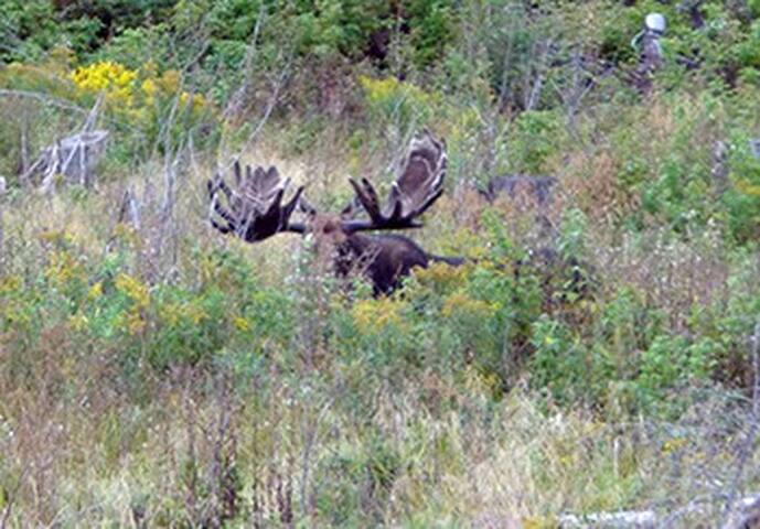
Allagash wilderness camps
1477 Main Streethttps://www.allagashwildernesscamps.com/
Camping, kayak & canoe rentals - bus transfers
Pelletier Campgrounds
Maine 161Camping, kayak & canoe rentals - bus transfers