
Hiking and Outdoors
Hiking and Outdoors
Note-always check websites for trail closures before heading out.
https://www.dupontstaterecreationalforest.com/Pages/Maps.aspx
Beautiful waterfalls, lakes and forests. My three recommendations are the three waterfalls, Bridal Veil Falls Loop and Cedar Rock Mountain. You can see the four falls, Hooker, Triple, High Falls and Bridal Veil Falls in one out and back hike if you’re up to 9+ miles. You can also see three lakes that are beautiful!
624 lokal ang nagrerekomenda
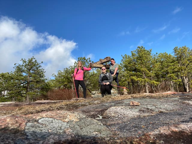
Gubat ng Estado ng Dupont
Staton RoadNote-always check websites for trail closures before heading out.
https://www.dupontstaterecreationalforest.com/Pages/Maps.aspx
Beautiful waterfalls, lakes and forests. My three recommendations are the three waterfalls, Bridal Veil Falls Loop and Cedar Rock Mountain. You can see the four falls, Hooker, Triple, High Falls and Bridal Veil Falls in one out and back hike if you’re up to 9+ miles. You can also see three lakes that are beautiful!
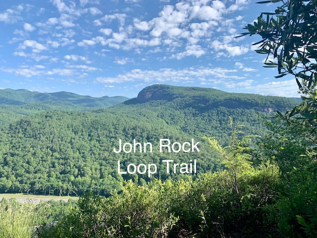
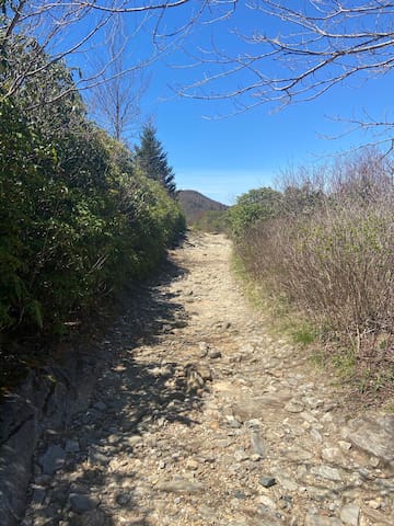
John Rock Loop Trail. This truly is my favorite trail to do. I’ve done multiple times and completed the loop clockwise and counterclockwise. My recommendation is clockwise. Starts out with a nice walk along the River then you’ll start climbing. You’re gonna get a workout. Once you reach the overlook, don’t be discouraged to see that you are still climbing. I promise you’re almost at the top. Once you’re actually at the top, there’s a steep but short descent, then it’s an easy 3.4-4 miles from there.😬 The climb going counter clockwise is more gradual but seems excruciatingly long in my opinion. I’d rather knock it out. With all of that said, this is the most scenic trail in Pisgah Forest in my opinion. I’m excited to see it had been reopened after Hurricane Fred. From what I read on All Trails, there are still some detours but they don’t sound too bad. You have to park a little ways from the fish hatchery to park as the parking lot is still not accessible but it sounds like all of this only adds about half a mile to your hike, so this will be in the 7 mile range. Worth every step. The scenery changes a lot, you have a beautiful look off and a waterfall close to the end if you went clockwise. I highly recommend this trail! Couldn’t
25 lokal ang nagrerekomenda
Pisgah Center For Wildlife Edu
1401 Fish Hatchery RdJohn Rock Loop Trail. This truly is my favorite trail to do. I’ve done multiple times and completed the loop clockwise and counterclockwise. My recommendation is clockwise. Starts out with a nice walk along the River then you’ll start climbing. You’re gonna get a workout. Once you reach the overlook, don’t be discouraged to see that you are still climbing. I promise you’re almost at the top. Once you’re actually at the top, there’s a steep but short descent, then it’s an easy 3.4-4 miles from there.😬 The climb going counter clockwise is more gradual but seems excruciatingly long in my opinion. I’d rather knock it out. With all of that said, this is the most scenic trail in Pisgah Forest in my opinion. I’m excited to see it had been reopened after Hurricane Fred. From what I read on All Trails, there are still some detours but they don’t sound too bad. You have to park a little ways from the fish hatchery to park as the parking lot is still not accessible but it sounds like all of this only adds about half a mile to your hike, so this will be in the 7 mile range. Worth every step. The scenery changes a lot, you have a beautiful look off and a waterfall close to the end if you went clockwise. I highly recommend this trail! Couldn’t
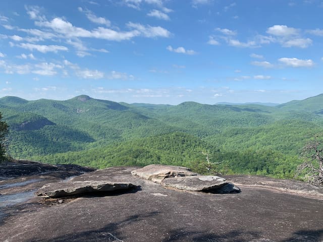
This is a great hike for all seasons. I wouldn’t recommend the very top if it’s icy of course. The view from the first look off below the helipad is just as pretty in my opinion but both are worth seeing. The last stretch of trail from the helipad to the top is a little more strenuous but not terrible. If you’re afraid of bights like me, you will probably find that you are able to enjoy the first look off more because the rock face isn’t as steep. Vertigo kicks in at the top for me but I still go! I’m determined to overcome that.
The trail to the first look off isn’t super obvious. Once you’re on the helipad, walk down toward the right. There’s a short trail that will lead you down and to the right across a rocky spot. Just keep going down and to the right. It’s not far at all. If you have kids with you, this is definitely safer than the top for them. You can also see this on All Trails.
37 lokal ang nagrerekomenda
Looking Glass Rock Trailhead
This is a great hike for all seasons. I wouldn’t recommend the very top if it’s icy of course. The view from the first look off below the helipad is just as pretty in my opinion but both are worth seeing. The last stretch of trail from the helipad to the top is a little more strenuous but not terrible. If you’re afraid of bights like me, you will probably find that you are able to enjoy the first look off more because the rock face isn’t as steep. Vertigo kicks in at the top for me but I still go! I’m determined to overcome that.
The trail to the first look off isn’t super obvious. Once you’re on the helipad, walk down toward the right. There’s a short trail that will lead you down and to the right across a rocky spot. Just keep going down and to the right. It’s not far at all. If you have kids with you, this is definitely safer than the top for them. You can also see this on All Trails.
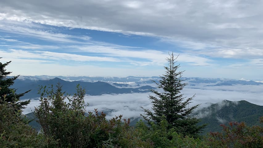
360 degrees of gorgeous views for most of this hike. Wear sunscreen!
168 lokal ang nagrerekomenda
Black Balsam Knob
Art Loeb Trail360 degrees of gorgeous views for most of this hike. Wear sunscreen!
Beautiful views on this hike and it leads to an old Cessna that crashed here in 1983. Not a hike for the faint of heart but worth it! Only 2.5 miles round trip but it’s pretty brutal. Your legs and knees will talk to you about this one but man it’s fun! Hike to Waterrock Knob (0.75 miles) is steep but well maintained. The trail to Browning Knob and the plane crash site branches off to the left just before you reach the Waterrock Knob look off. It is 0.5 miles and frequently traveled but not maintained. It’s steep, muddy and rooty but I’ve done it twice and I’m no pro so it’s doable. I suggest hiking poles, good boots (no street shoes) and take your time and a change of clothes. I chose to go down a few places on my bum rather than risk falling so I came out rather muddy. If you choose to do this one, you can reach out to me for a little more info or check it out on All Trails. I would not recommend this hike for small kids.
87 lokal ang nagrerekomenda
Waterrock Knob
Beautiful views on this hike and it leads to an old Cessna that crashed here in 1983. Not a hike for the faint of heart but worth it! Only 2.5 miles round trip but it’s pretty brutal. Your legs and knees will talk to you about this one but man it’s fun! Hike to Waterrock Knob (0.75 miles) is steep but well maintained. The trail to Browning Knob and the plane crash site branches off to the left just before you reach the Waterrock Knob look off. It is 0.5 miles and frequently traveled but not maintained. It’s steep, muddy and rooty but I’ve done it twice and I’m no pro so it’s doable. I suggest hiking poles, good boots (no street shoes) and take your time and a change of clothes. I chose to go down a few places on my bum rather than risk falling so I came out rather muddy. If you choose to do this one, you can reach out to me for a little more info or check it out on All Trails. I would not recommend this hike for small kids.
This is an “easier” hike in Pisgah Forest. Keeping in mind, you’re always going to encounter some elevation change in the mountains. It isn’t flat but definitely an easier one. It’s about a 6 mile loop with an option to cut it in half. It is a beautiful walk through the forest. Again I’m a big fan of the early mornings when the suns rays are just peaking through the trees. It’s so peaceful. There is a trail about half way that you can take back to shorten the distance. Going clockwise if curd back to the right, counter-clockwise, cuts back to the left. There’s a picnic area and restrooms at the trailhead. Suitable for kids. As of today, 9/29/21 this trail is open to my knowledge. Just keep in mind Pisgah Forest took a hard hit with Hurricane Fred. There may be trees down. Check the following link for trail conditions in Pisgah.
https://www.fs.usda.gov/alerts/nfsnc/alerts-notices/?aid=68824
24 lokal ang nagrerekomenda
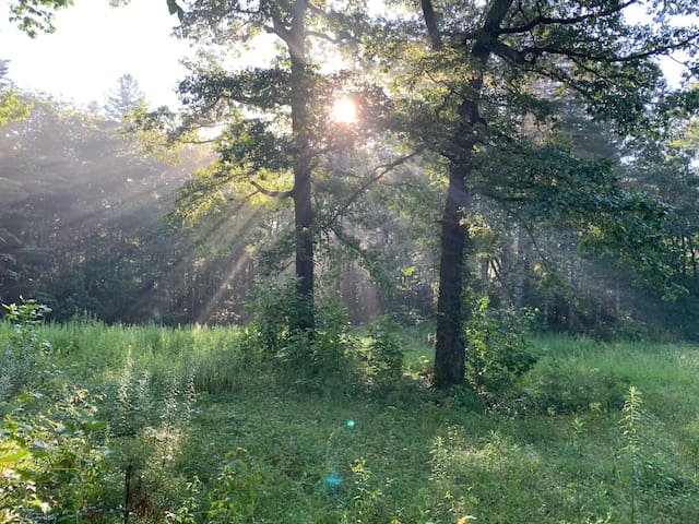
Pink Beds Trail Loop
U.S. 276This is an “easier” hike in Pisgah Forest. Keeping in mind, you’re always going to encounter some elevation change in the mountains. It isn’t flat but definitely an easier one. It’s about a 6 mile loop with an option to cut it in half. It is a beautiful walk through the forest. Again I’m a big fan of the early mornings when the suns rays are just peaking through the trees. It’s so peaceful. There is a trail about half way that you can take back to shorten the distance. Going clockwise if curd back to the right, counter-clockwise, cuts back to the left. There’s a picnic area and restrooms at the trailhead. Suitable for kids. As of today, 9/29/21 this trail is open to my knowledge. Just keep in mind Pisgah Forest took a hard hit with Hurricane Fred. There may be trees down. Check the following link for trail conditions in Pisgah.
https://www.fs.usda.gov/alerts/nfsnc/alerts-notices/?aid=68824
A great family place. Trails for hiking. Take the kids to see and pet the goats. You can tour the house for a small fee and during certain hours.
174 lokal ang nagrerekomenda
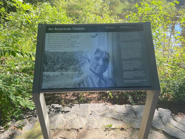
Carl Sandburg Home National Historic Site
1800 Little River RdA great family place. Trails for hiking. Take the kids to see and pet the goats. You can tour the house for a small fee and during certain hours.
If you want a view without a hike or long drive this is perfect. It is a popular spot for watching sunset so plan to arrive a little early. There are a few short trails here as well.
135 lokal ang nagrerekomenda
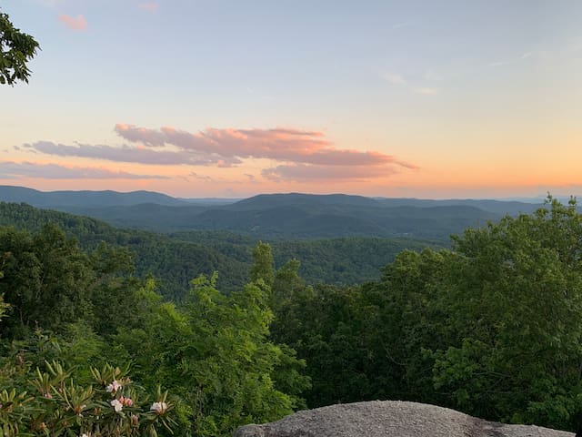
Lundagang Bato
4501 Laurel Park HwyIf you want a view without a hike or long drive this is perfect. It is a popular spot for watching sunset so plan to arrive a little early. There are a few short trails here as well.