
Sarah's Guidebook
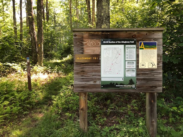
Allegheny Trail Access
Very popular trail in the Potomac Highlands
We have the Allegheny trailhead access point just 2 miles south from the cabins. Located directly off of Glady Rd/Rt 27. Gravel Parking lot is right off Rt 27.
Glady
We have the Allegheny trailhead access point just 2 miles south from the cabins. Located directly off of Glady Rd/Rt 27. Gravel Parking lot is right off Rt 27.
Sightseeing
The highest point in West Virginia with the most amazing views! Only an hour from the cabin. Multiple points of access either through the forest roads or via the paved route on the east side.
37 lokal ang nagrerekomenda
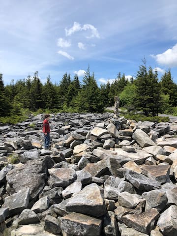
Spruce Knob
The highest point in West Virginia with the most amazing views! Only an hour from the cabin. Multiple points of access either through the forest roads or via the paved route on the east side.
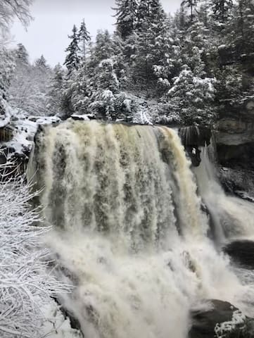
Blackwater Falls
Beautiful anytime of the year no matter the weather.
Beautiful lake surrounded by red spruce and nice walk ways.
7 lokal ang nagrerekomenda
Spruce Knob Lake
Beautiful lake surrounded by red spruce and nice walk ways.
On the way to Spruce Knob, it’s a fine geologic formation to see. Get even closer by taking the hike up there which I believe is about 3 miles but so worth it!
The last time we hiked it, our 3 year old was determined to hike all the way up and he did it! On the way down, he rode on daddy’s shoulders. :-)
36 lokal ang nagrerekomenda
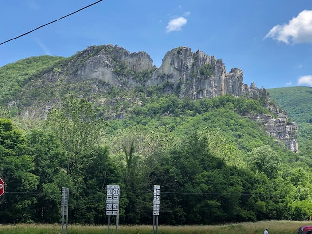
Seneca Rocks
On the way to Spruce Knob, it’s a fine geologic formation to see. Get even closer by taking the hike up there which I believe is about 3 miles but so worth it!
The last time we hiked it, our 3 year old was determined to hike all the way up and he did it! On the way down, he rode on daddy’s shoulders. :-)
Food scene

Alpine Lodge
U.S. 33Good place for breakfast! They were open at 8am on the weekends as of June 2020.
Play
Fabulous trails, views and people! Canaan Valley is certainly a natural snow machine in the winter. The elevation and geographic location allow it to receive significant upslope snow (Orographic lift) regularly during the winter! This is why I love coming here. It's only a few hours from the DC area.
41 lokal ang nagrerekomenda
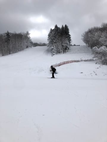
Canaan Valley Ski Resort
Park Road 826Fabulous trails, views and people! Canaan Valley is certainly a natural snow machine in the winter. The elevation and geographic location allow it to receive significant upslope snow (Orographic lift) regularly during the winter! This is why I love coming here. It's only a few hours from the DC area.
One of the two via ferrata experiences on the east coast. With over 1000 ft in elevation, there is suspension bridge that is 150 ft high and 200 ft long. The trip is around 3.5 hrs. long, they also offer full-moon tours as well. There are also 2 escape points if it were to become too difficult for you. A very exciting challenge indeed!
6 lokal ang nagrerekomenda
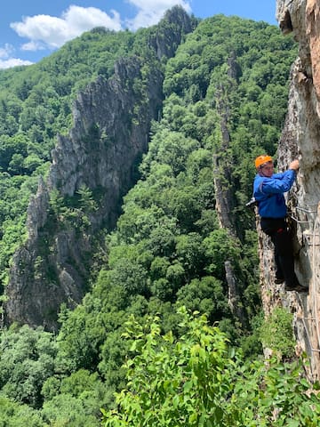
Nelson Rocks
One of the two via ferrata experiences on the east coast. With over 1000 ft in elevation, there is suspension bridge that is 150 ft high and 200 ft long. The trip is around 3.5 hrs. long, they also offer full-moon tours as well. There are also 2 escape points if it were to become too difficult for you. A very exciting challenge indeed!
Other Nearby Trails
Several of the local folks recommend this trail! It's a 7.7 mile lightly trafficked out and back trail located near Glady, West Virginia that features a waterfall and is rated as moderate. The trail is primarily used for hiking and mountain biking and is best used from April until October. Dogs must be kept on leash. Rocky dirt trail. Less than 8 miles from the cabin! Parallels a railroad.
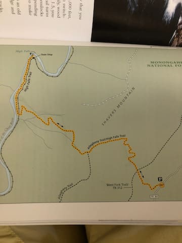
High Falls Trail
High Falls TrailSeveral of the local folks recommend this trail! It's a 7.7 mile lightly trafficked out and back trail located near Glady, West Virginia that features a waterfall and is rated as moderate. The trail is primarily used for hiking and mountain biking and is best used from April until October. Dogs must be kept on leash. Rocky dirt trail. Less than 8 miles from the cabin! Parallels a railroad.
Laurel Fork Wilderness has 18.5 miles of trails, many of which follow old railroad grades and logging roads. Several possible loop hikes can made by combining trails. Fords of streams may be a problem to cross during high water events. There may be additional small stream crossings depending on water levels. ccessible from the north via U.S. Route 33 east from Elkins or west from Harman to the top of Middle Mountain. Take Forest Road 14 south. This road is the western boundary of both Wildernesses.
Laurel Fork South Wilderness
Laurel Fork Wilderness has 18.5 miles of trails, many of which follow old railroad grades and logging roads. Several possible loop hikes can made by combining trails. Fords of streams may be a problem to cross during high water events. There may be additional small stream crossings depending on water levels. ccessible from the north via U.S. Route 33 east from Elkins or west from Harman to the top of Middle Mountain. Take Forest Road 14 south. This road is the western boundary of both Wildernesses.