
Val Seriana by local
Passeggiate - Hiking
Our place is located in the Orobie's Park, which has great hiking for beginners and for experts, shorts and longer. In this list, I will suggest my favorite ones.
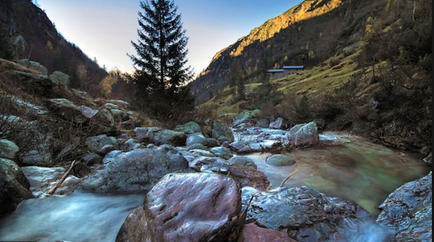
This is one of my favorite hiking in the area.
The start is in Rovetta, in 1 hour you will reach the chapel where you can join a picnic lunch. Over there, the view is amazing: you can see all the small villages around.
If you are expert hiker: you can also start from Piario, it will last 2 hours and a half to reach the chapel, the hiking is amazing.
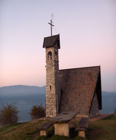
Cappella Alpini Monte Blum
This is one of my favorite hiking in the area.
The start is in Rovetta, in 1 hour you will reach the chapel where you can join a picnic lunch. Over there, the view is amazing: you can see all the small villages around.
If you are expert hiker: you can also start from Piario, it will last 2 hours and a half to reach the chapel, the hiking is amazing.
Long hiking.
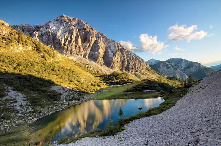
This area is uncontaminated, peaceful and beautiful: green mountains, light blue waterand ibex.
At the top there is a shelter, where you can eat, drink and also sleep if you desire (http://www.rifugiolaghigemelli.it/modules_cms/HomePage.php).
• da/from Valcanale » sentiero/path n. 216 » ore 4.00 h
• da/ from Valgoglio » per la Val Sanguigno sentiero/path n. 232 » ore 5.00 h
» per/ through il Passo Aviasco sentiero/path n. 228-229-214 » ore 5.00 h
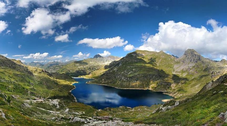
Laghi Gemelli
Long hiking.
This area is uncontaminated, peaceful and beautiful: green mountains, light blue waterand ibex.
At the top there is a shelter, where you can eat, drink and also sleep if you desire (http://www.rifugiolaghigemelli.it/modules_cms/HomePage.php).
• da/from Valcanale » sentiero/path n. 216 » ore 4.00 h
• da/ from Valgoglio » per la Val Sanguigno sentiero/path n. 232 » ore 5.00 h
» per/ through il Passo Aviasco sentiero/path n. 228-229-214 » ore 5.00 h
1 e 30 h of hiking, where the Serio's waterfalls starts.
Number of the path: 305.
It starts from the Beltrame hamlet of Valbondione (940 m). Following the road to Lizzola, after the bend on the right (about 200 m) near a bar, a dirt road starts on the left and, with a regular slope, goes into the woods. Rising up it goes up the side of the valley, leaving down the course of the Serio river. After crossing some valleys you reach the lower station of the cable car that transports the food to the refuge. The dirt road now becomes a mule track which, going out of the woods, continues to rise to then bend sharply south and make several hairpin bends.
There is a variant on the first section: leave the car in Grumetti and go up into the woods until you cross the forest road that starts from Beltrame and then follows as described above.
Rifugio Antonio Curò
1 e 30 h of hiking, where the Serio's waterfalls starts.
Number of the path: 305.
It starts from the Beltrame hamlet of Valbondione (940 m). Following the road to Lizzola, after the bend on the right (about 200 m) near a bar, a dirt road starts on the left and, with a regular slope, goes into the woods. Rising up it goes up the side of the valley, leaving down the course of the Serio river. After crossing some valleys you reach the lower station of the cable car that transports the food to the refuge. The dirt road now becomes a mule track which, going out of the woods, continues to rise to then bend sharply south and make several hairpin bends.
There is a variant on the first section: leave the car in Grumetti and go up into the woods until you cross the forest road that starts from Beltrame and then follows as described above.
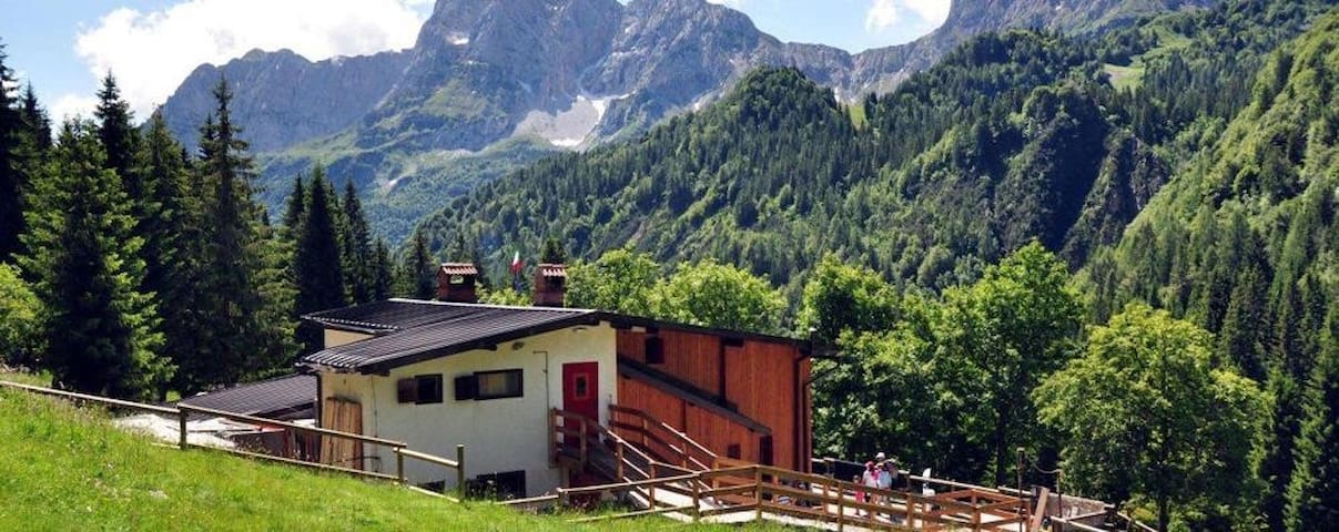
This is one of the easiest path, just 1 hour: great for family and kids.
The refuge (at an altitude of 1410 m), easily accessible from the town of Valcanale, is immersed in a splendid pine forest in an environment of the most suggestive. In addition to being the first stop on the Sentiero delle Orobie Orientali, the refuge is also a valuable base for reaching the Lake Branchino area or for interesting itineraries.
Since 2007 the renovation and redevelopment work have made it accessible also to "disabled" people. .
Alpe Corta Bassa
This is one of the easiest path, just 1 hour: great for family and kids.
The refuge (at an altitude of 1410 m), easily accessible from the town of Valcanale, is immersed in a splendid pine forest in an environment of the most suggestive. In addition to being the first stop on the Sentiero delle Orobie Orientali, the refuge is also a valuable base for reaching the Lake Branchino area or for interesting itineraries.
Since 2007 the renovation and redevelopment work have made it accessible also to "disabled" people. .
The Moschel huts offer an unmissable scenario of the Orobic Prealps: green meadows, huts, rivers and pools of water.
The route is ideal for solo travelers, couples and families with children. From Villa d'Ogna, after passing the villages of Nasolino and Valzurio, you reach Spinelli. We recommend that you reach the latter by car and then continue on foot following the road to reach the huts of the Moschel in an hour.
On the way back, we suggest a stop in Valzurio, a typical village with a small bar to refresh yourself.
(It is also possible to continue by car HOWEVER you have to buy a daily ticket, issued by the machine in the parking lot)
Baite del Möschel
The Moschel huts offer an unmissable scenario of the Orobic Prealps: green meadows, huts, rivers and pools of water.
The route is ideal for solo travelers, couples and families with children. From Villa d'Ogna, after passing the villages of Nasolino and Valzurio, you reach Spinelli. We recommend that you reach the latter by car and then continue on foot following the road to reach the huts of the Moschel in an hour.
On the way back, we suggest a stop in Valzurio, a typical village with a small bar to refresh yourself.
(It is also possible to continue by car HOWEVER you have to buy a daily ticket, issued by the machine in the parking lot)
Val Vertova is one of the most suggestive corners of the middle Val Seriana. A flat path, also suitable for children, immersed in the coolness of the forest along the river. Splendid views open continuously between jumps of crystalline water, crystal clear pools of incredible colors and rich vegetation. Impossible not to stop to take some photos or to enjoy a refreshing bath.
From Cà Rosèt ("Circolo della Valle - Val Vertova" municipal parking € 5) take the CAI 527 mule track that runs along the river and, after having forded it twice, you will meet the small bridge at the entrance to the Sterladech river in Vertova River; here it is possible to admire the splendid waterfalls of Val Vertova. Continuing for another 20 minutes of walking, at the crossroads between path 527 and path 525A, keep right to reach the metal gate. Resume path 527 and continue for another 30 minutes to reach the Sources.
If desired, the route continues further, becoming a mountain path to all intents and purposes, to get to the Testa bivouac located at the foot of Mount Alben (take about 3 more hours).
https://www.valseriana.eu/valvertova/
Val Vertova Roset
Via Cinque MartiriVal Vertova is one of the most suggestive corners of the middle Val Seriana. A flat path, also suitable for children, immersed in the coolness of the forest along the river. Splendid views open continuously between jumps of crystalline water, crystal clear pools of incredible colors and rich vegetation. Impossible not to stop to take some photos or to enjoy a refreshing bath.
From Cà Rosèt ("Circolo della Valle - Val Vertova" municipal parking € 5) take the CAI 527 mule track that runs along the river and, after having forded it twice, you will meet the small bridge at the entrance to the Sterladech river in Vertova River; here it is possible to admire the splendid waterfalls of Val Vertova. Continuing for another 20 minutes of walking, at the crossroads between path 527 and path 525A, keep right to reach the metal gate. Resume path 527 and continue for another 30 minutes to reach the Sources.
If desired, the route continues further, becoming a mountain path to all intents and purposes, to get to the Testa bivouac located at the foot of Mount Alben (take about 3 more hours).
https://www.valseriana.eu/valvertova/
The Regina or BiGiClo cycle path and is well signposted along the entire route with kilometer indications and information panels on the typical flora and fauna of the river, it is not difficult to spot wild rabbits and ibises along the way. It starts from Ranica and uninterruptedly reaches Clusone after more than 31 kilometers.
Starting from Clusone, the road is unique and you cross the Serio river several times on beautiful new wooden bridges or ancient medieval bridges that were abandoned in the past. From Albino to Alzano there are two route choices respectively on the right and left of the orographic bank of the river Serio.
This cycle path is illuminated in the Albino-Ranica stretch, 10 km illuminated very useful when we are late in the evening on the return.
The Serio di Alzano Lombardo and Villa di serio park are very beautiful, connected to each other, they give you the opportunity to take two rides with the family on circular routes.
Pista Ciclabile Valle Seriana
Via della ConciliazioneThe Regina or BiGiClo cycle path and is well signposted along the entire route with kilometer indications and information panels on the typical flora and fauna of the river, it is not difficult to spot wild rabbits and ibises along the way. It starts from Ranica and uninterruptedly reaches Clusone after more than 31 kilometers.
Starting from Clusone, the road is unique and you cross the Serio river several times on beautiful new wooden bridges or ancient medieval bridges that were abandoned in the past. From Albino to Alzano there are two route choices respectively on the right and left of the orographic bank of the river Serio.
This cycle path is illuminated in the Albino-Ranica stretch, 10 km illuminated very useful when we are late in the evening on the return.
The Serio di Alzano Lombardo and Villa di serio park are very beautiful, connected to each other, they give you the opportunity to take two rides with the family on circular routes.
The cycle path of the upper Seriana valley is a cycle path that winds through the upper Seriana valley close to the Serio river for 24 km, an opportunity to cycle immersed in nature, through woods, bridges over streams and hydroelectric power stations. Along the cycle path we will have the opportunity to enjoy very beautiful mountain views and cross characteristic villages with stone walls and slate roofs.
A path that is challenging at times as it has some short ups and downs even with high slopes.
57% of the Alta Valle Seriana cycle path is on its own site mainly with bituminous surface, in the stretches from Ogna to Ardesio you ride on a road with little traffic and between Ponte Seghe and Gromo you ride on an average busy road, as always, attention and caution are needed but it is not particularly annoying because they are roads surrounded by greenery.
Along the way you will have the opportunity to observe the most beautiful peaks of the Bergamo area such as the Devil of Tent, Redorta, Pizzo Coca, Monte Gleno and Torena.
The departure is Clusone and passes through Groppino (fraction of Piario).
Pista ciclabile Alta Valle Seriana
Viale Alessandro ManzoniThe cycle path of the upper Seriana valley is a cycle path that winds through the upper Seriana valley close to the Serio river for 24 km, an opportunity to cycle immersed in nature, through woods, bridges over streams and hydroelectric power stations. Along the cycle path we will have the opportunity to enjoy very beautiful mountain views and cross characteristic villages with stone walls and slate roofs.
A path that is challenging at times as it has some short ups and downs even with high slopes.
57% of the Alta Valle Seriana cycle path is on its own site mainly with bituminous surface, in the stretches from Ogna to Ardesio you ride on a road with little traffic and between Ponte Seghe and Gromo you ride on an average busy road, as always, attention and caution are needed but it is not particularly annoying because they are roads surrounded by greenery.
Along the way you will have the opportunity to observe the most beautiful peaks of the Bergamo area such as the Devil of Tent, Redorta, Pizzo Coca, Monte Gleno and Torena.
The departure is Clusone and passes through Groppino (fraction of Piario).
An excursion for expert mountaineers (4 h) to the highest refuge of the Orobie, with spectacular views.
From Ronco di Schilpario (1075 m) take the mule track that climbs regularly along the Vo valley, CAI 413. Near the waterfalls (deviation to the right) the path climbs with bends in the woods and continues along the left side (right orographic).
At an altitude of 1650 (Venano di Mezzo) you cross the stream (wooden bridge) and climb more decisively to the Venano di Sopra basin (1850 m), which you cross to resume the climb on the mule track, with a constant slope and wide hairpin bends up to an altitude of 2202 m. From here, turn north and, with a gentler route, you arrive at the Nani Tagliaferri Refuge (2328 m). Through the same path you reach Ronco again.
For the intrepid, highly trained, we recommend taking the Antonio Curò nature trail, reaching the Venerocolo lakes, then the CAI 414 path, and returning to Ronco.
Rifugio Nani Tagliaferri
Frazione RoncoAn excursion for expert mountaineers (4 h) to the highest refuge of the Orobie, with spectacular views.
From Ronco di Schilpario (1075 m) take the mule track that climbs regularly along the Vo valley, CAI 413. Near the waterfalls (deviation to the right) the path climbs with bends in the woods and continues along the left side (right orographic).
At an altitude of 1650 (Venano di Mezzo) you cross the stream (wooden bridge) and climb more decisively to the Venano di Sopra basin (1850 m), which you cross to resume the climb on the mule track, with a constant slope and wide hairpin bends up to an altitude of 2202 m. From here, turn north and, with a gentler route, you arrive at the Nani Tagliaferri Refuge (2328 m). Through the same path you reach Ronco again.
For the intrepid, highly trained, we recommend taking the Antonio Curò nature trail, reaching the Venerocolo lakes, then the CAI 414 path, and returning to Ronco.
Easy trekking - child friendly: round trip 2h.
Val Sanguigno is the green oasis with the highest biodiversity of the Orobie Park with a suggestive view given by the stream, which creates transparent pools, such as Lake Aviasco.
Reach the Aviasco power plant (965m) by car as well as the town of Valgoglio, with parking tickets issued at the automatic dispenser near the Municipality of Valgoglio.
Leaving the car, we follow the signs, CAI 267, which make us descend under the power plant and cross the Goglio stream on a bridge. The path climbs steeply in the middle of the woods (15 minutes), skims the Sersen barn and shortly after joins a mule track also coming from the Aviasco power plant. We take the beautiful mule track on the left with which we reach and flank the stream that descends from the Sanguigno valley. We climb up to the locality of the "cascatelle" and, continuing in a beautiful beech forest, we soon arrive in sight of the Gianpace refuge (1331 m).
Valle Sanguigno
Easy trekking - child friendly: round trip 2h.
Val Sanguigno is the green oasis with the highest biodiversity of the Orobie Park with a suggestive view given by the stream, which creates transparent pools, such as Lake Aviasco.
Reach the Aviasco power plant (965m) by car as well as the town of Valgoglio, with parking tickets issued at the automatic dispenser near the Municipality of Valgoglio.
Leaving the car, we follow the signs, CAI 267, which make us descend under the power plant and cross the Goglio stream on a bridge. The path climbs steeply in the middle of the woods (15 minutes), skims the Sersen barn and shortly after joins a mule track also coming from the Aviasco power plant. We take the beautiful mule track on the left with which we reach and flank the stream that descends from the Sanguigno valley. We climb up to the locality of the "cascatelle" and, continuing in a beautiful beech forest, we soon arrive in sight of the Gianpace refuge (1331 m).
Trekking in Val Sedornia (6 h round trip) is ideal for those who want to get close to the mountains and visit one of the most fascinating alpine lakes in the Seriana Valley: Lake Spigorel.
Among the oldest witnesses, we find the Masso Altare: a stone dating back to a few centuries after the birth of Christ. Legend even tells that the stone was used by Druid priests to perform rites of sacrifices.
A few steps from the beginning of the path, from the Tezzi Alti locality (969 m), take the Val Sedornia with the forest road, up to the Chapel of S. Carlo (1163 m): CAI 309.
Crossed the stream, you cross path 313 coming from Boario di Gromo. Following the forest road that climbs through the meadows of the locality Stalle Prato di Vigna and which, at an altitude of about 1350 m, turns sharply right into the woods.
After about 400 m, near a valley, you leave the road and take the path on the left that climbs towards the north and which reaches, now with a path between meadows and woods, the Bassa Vigna Vaga hut (1507 m) and, at follow, the hut of Mezzo Vigna Vaga (1660).
Continue the climb in a more open environment, reaching the Spigorel lake (1821 m). Continuing in the direction of Mount Barbarossa, you cross path 401 at an altitude of about 2000 m. The return takes place on the same route as the outward journey.
Val Sedornia
Trekking in Val Sedornia (6 h round trip) is ideal for those who want to get close to the mountains and visit one of the most fascinating alpine lakes in the Seriana Valley: Lake Spigorel.
Among the oldest witnesses, we find the Masso Altare: a stone dating back to a few centuries after the birth of Christ. Legend even tells that the stone was used by Druid priests to perform rites of sacrifices.
A few steps from the beginning of the path, from the Tezzi Alti locality (969 m), take the Val Sedornia with the forest road, up to the Chapel of S. Carlo (1163 m): CAI 309.
Crossed the stream, you cross path 313 coming from Boario di Gromo. Following the forest road that climbs through the meadows of the locality Stalle Prato di Vigna and which, at an altitude of about 1350 m, turns sharply right into the woods.
After about 400 m, near a valley, you leave the road and take the path on the left that climbs towards the north and which reaches, now with a path between meadows and woods, the Bassa Vigna Vaga hut (1507 m) and, at follow, the hut of Mezzo Vigna Vaga (1660).
Continue the climb in a more open environment, reaching the Spigorel lake (1821 m). Continuing in the direction of Mount Barbarossa, you cross path 401 at an altitude of about 2000 m. The return takes place on the same route as the outward journey.
Near the town of Gromo there is a trek that winds through the Cardeto lakes, the Cardeto blueberries and breathtaking views.
From Gromo we drive up to Ripa Bassa (859 m) where you can park your car. We take the Cai path 233 which begins with an agro-forestry-pastoral road to the right of the Burlandi farm. Heading north along the forest road and mule track, we cross an area full of huts and meadows up to an altitude of about 1200 m, where we enter a dense forest. After about 40 minutes we reach the Nodulo hut, immediately after the path leaves the vegetation and offers a wide view of the high Val Seriana. We continue on the CAI path 233 starting to go around the slopes of Mount Madonnino and slowly gain altitude. Reached some obvious indications on the rock we have two possibilities: taking to the left (path cai 233A) we deviate in the direction of the homonymous Cardeto lakes while, continuing we arrive at the Cardeto hut (1850 m) and ends at Passo della Portula. For the tireless, continue to the Calvi Refuge.
The trek to Passo della Portula is 4 hours of walking, while the Cardeto Lakes can be reached in 2 hours and 45 minutes.
Passo della Portula
Near the town of Gromo there is a trek that winds through the Cardeto lakes, the Cardeto blueberries and breathtaking views.
From Gromo we drive up to Ripa Bassa (859 m) where you can park your car. We take the Cai path 233 which begins with an agro-forestry-pastoral road to the right of the Burlandi farm. Heading north along the forest road and mule track, we cross an area full of huts and meadows up to an altitude of about 1200 m, where we enter a dense forest. After about 40 minutes we reach the Nodulo hut, immediately after the path leaves the vegetation and offers a wide view of the high Val Seriana. We continue on the CAI path 233 starting to go around the slopes of Mount Madonnino and slowly gain altitude. Reached some obvious indications on the rock we have two possibilities: taking to the left (path cai 233A) we deviate in the direction of the homonymous Cardeto lakes while, continuing we arrive at the Cardeto hut (1850 m) and ends at Passo della Portula. For the tireless, continue to the Calvi Refuge.
The trek to Passo della Portula is 4 hours of walking, while the Cardeto Lakes can be reached in 2 hours and 45 minutes.
Offerta gastronomica
My personal favourite bars and restaurants, where you can enjoy something sweet, an ice-cream or having a good pizza or a special dinner.
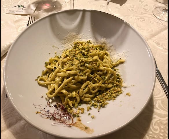
This is my favourite restaurant for special occasions: a romantic dinner, a family dinner or a Sunday lunch. The location is really beautiful and elegant with great food.
I will suggest to try pasta with truffle, you are in the right place.
6 lokal ang nagrerekomenda
Ristorante Mas-ci' - Albergo Commercio
1 Piazza del ParadisoThis is my favourite restaurant for special occasions: a romantic dinner, a family dinner or a Sunday lunch. The location is really beautiful and elegant with great food.
I will suggest to try pasta with truffle, you are in the right place.
Pasticceria Fantoni
18 Via Alcide De GasperiGreat bakery and pastry.
The typical architecture of the mountain buildings, the rustic environment and a menu with local and mainly home-grown products are winning conditions for a lunch or dinner in Val Seriana.
If it is impossible for you to stop for lunch or dinner, we suggest a short stop to buy cured meats (including salami, coppa and pancetta) and local cheeses (such as stracchino, taleggio and mountain cheese) that you can admire inside the cellar.
Agriturismo Malga Bassa
1100 Via Valle Di ScalveThe typical architecture of the mountain buildings, the rustic environment and a menu with local and mainly home-grown products are winning conditions for a lunch or dinner in Val Seriana.
If it is impossible for you to stop for lunch or dinner, we suggest a short stop to buy cured meats (including salami, coppa and pancetta) and local cheeses (such as stracchino, taleggio and mountain cheese) that you can admire inside the cellar.
The best cheese place in town for locals.
Formaggi Giudici or simply “La casa del Formaggio” is a small shop founded in 1952 specializing in the sale and refining of typical cheeses and dairy specialties from all over Europe.
TYPICAL CHEESES OF THE AREA:
Bossico cheese
Formagella Val di Scalve
Homemade Stracchino
Goat cheeses
Clusone tile
TYPICAL PRODUCTS:
Scarpinoc
Casoncelli
Rostrato red corn polenta from Rovetta
Flavored polenta
Formaggi Giudici Sas Di Giudici Enrico E C.
12 Piazza del ParadisoThe best cheese place in town for locals.
Formaggi Giudici or simply “La casa del Formaggio” is a small shop founded in 1952 specializing in the sale and refining of typical cheeses and dairy specialties from all over Europe.
TYPICAL CHEESES OF THE AREA:
Bossico cheese
Formagella Val di Scalve
Homemade Stracchino
Goat cheeses
Clusone tile
TYPICAL PRODUCTS:
Scarpinoc
Casoncelli
Rostrato red corn polenta from Rovetta
Flavored polenta
Visite turistiche
Historical places.
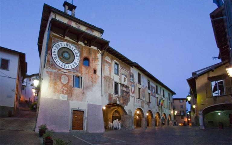
The precious gem of the Val Seriana is the small town of Clusone: with his narrow streets and historical building.
The most famous attractions are:
- la Danza macabra (famous painting)
- la basilica (the main cathedral)
- Church of Paradiso
- Corte Sant'Anna
- Museum MAT
38 lokal ang nagrerekomenda
Clusone
The precious gem of the Val Seriana is the small town of Clusone: with his narrow streets and historical building.
The most famous attractions are:
- la Danza macabra (famous painting)
- la basilica (the main cathedral)
- Church of Paradiso
- Corte Sant'Anna
- Museum MAT
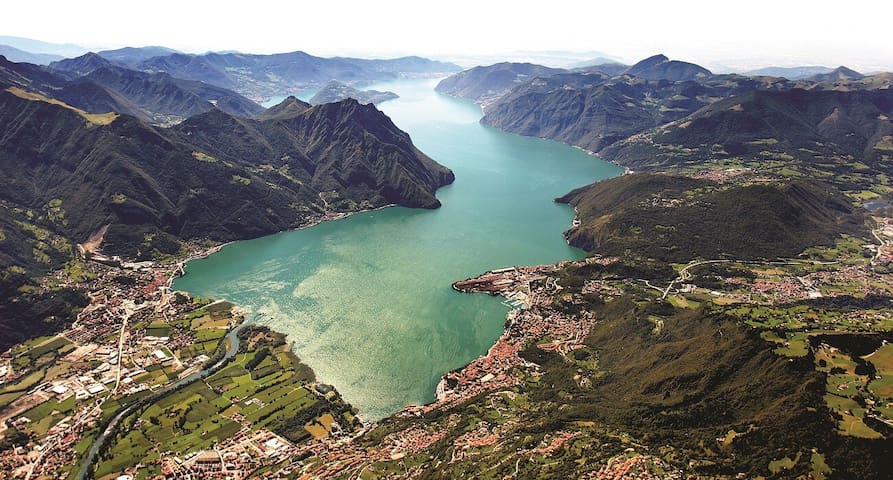
Iseo Lake is one of the main attraction of the area, in particular:
- Montisola: the largest lake's island of Europe. You can take a walk or cycle to see all the island.
- Lovere: small historical borgo with a crazy huge ice cream in "Bar Centrale", great view on the lake.
- Pisogne: small historical borgo, really precious, with a nice walk on the lake.
- Sarnico, Iseo
123 lokal ang nagrerekomenda
Lawa ng Iseo
Iseo Lake is one of the main attraction of the area, in particular:
- Montisola: the largest lake's island of Europe. You can take a walk or cycle to see all the island.
- Lovere: small historical borgo with a crazy huge ice cream in "Bar Centrale", great view on the lake.
- Pisogne: small historical borgo, really precious, with a nice walk on the lake.
- Sarnico, Iseo
35 minutes far by car.
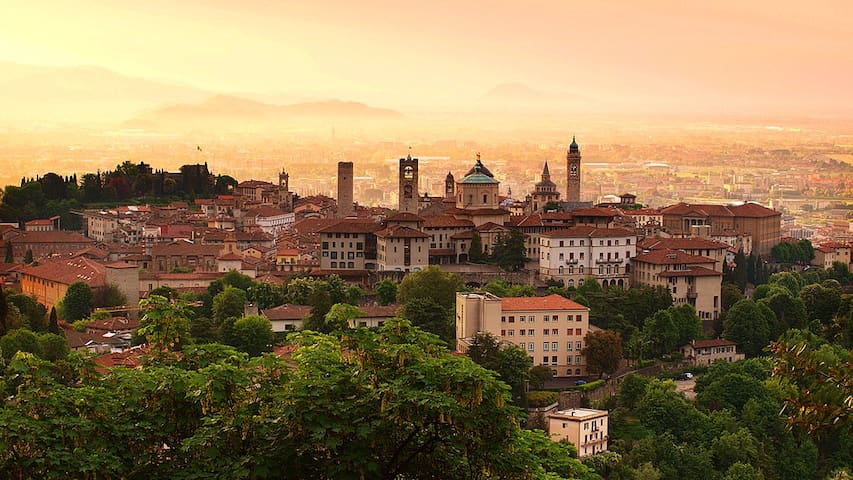
Just one of the most beautiful small towns in Italy, especially for the old upper town.
In the city:
- city center: via xx settembre, piazza pontida, via camozzi and via borgo santa caterina
- Doninzetti Theater
- museum: Accademia Carrara, Gamec
The upper old city: you can reach by foot (suggest to go throw via salita dalla scaletta, via sant'alessandro or piazza carrara) or funicular.
- City Walls
- Piazza Vecchia
- Basilica di Santa Maria Maggiore
- Cappella Colleoni
- Funicolar
- Palazzo della Ragione
- Orto botannico
201 lokal ang nagrerekomenda
Bergamo
35 minutes far by car.
Just one of the most beautiful small towns in Italy, especially for the old upper town.
In the city:
- city center: via xx settembre, piazza pontida, via camozzi and via borgo santa caterina
- Doninzetti Theater
- museum: Accademia Carrara, Gamec
The upper old city: you can reach by foot (suggest to go throw via salita dalla scaletta, via sant'alessandro or piazza carrara) or funicular.
- City Walls
- Piazza Vecchia
- Basilica di Santa Maria Maggiore
- Cappella Colleoni
- Funicolar
- Palazzo della Ragione
- Orto botannico
This place is not only special for its architecture but mainly for its view, being sheer on the rock: it is possible to fully see the Seriana valley, its mountains and its woods.
It is also pleasant to have a snack or refresh yourself at the sanctuary bar, which is mainly open in the summer season.
The place can be reached either on foot or by car through a steep climb.
Santuario di San Patrizio
26 Via S. PatrizioThis place is not only special for its architecture but mainly for its view, being sheer on the rock: it is possible to fully see the Seriana valley, its mountains and its woods.
It is also pleasant to have a snack or refresh yourself at the sanctuary bar, which is mainly open in the summer season.
The place can be reached either on foot or by car through a steep climb.
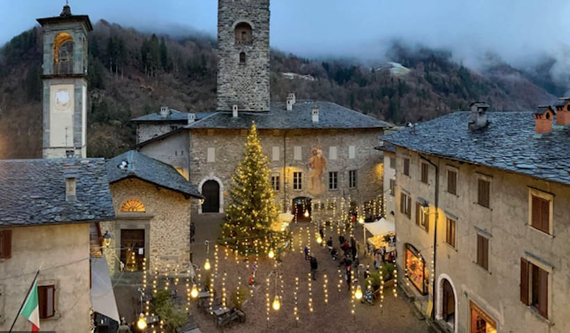
Gromo, included among the most beautiful villages in Italy, retains the typical structure of mountain villages: narrow alleys and stairways, houses with stone balconies and loggias, and traditional slate roofs.
The tour begins in the spectacular Piazza Dante with the thirteenth-century Ginami castle, the Milesi palace (1443, now the Town Hall) with the elegant loggia, the civic archive with the precious parchments, the church of San Gregorio with its altarpiece seventeenth century in which the village is depicted as it was. Follows the central fountain that carries the swan, cultural emblem, on the throne; the liberty villas built in the early twentieth century, when Gromo became a fashionable holiday resort.
But we still have to see the monument that best expresses the artistic refinement, the church of San Giacomo.
9 lokal ang nagrerekomenda
Gromo
Gromo, included among the most beautiful villages in Italy, retains the typical structure of mountain villages: narrow alleys and stairways, houses with stone balconies and loggias, and traditional slate roofs.
The tour begins in the spectacular Piazza Dante with the thirteenth-century Ginami castle, the Milesi palace (1443, now the Town Hall) with the elegant loggia, the civic archive with the precious parchments, the church of San Gregorio with its altarpiece seventeenth century in which the village is depicted as it was. Follows the central fountain that carries the swan, cultural emblem, on the throne; the liberty villas built in the early twentieth century, when Gromo became a fashionable holiday resort.
But we still have to see the monument that best expresses the artistic refinement, the church of San Giacomo.
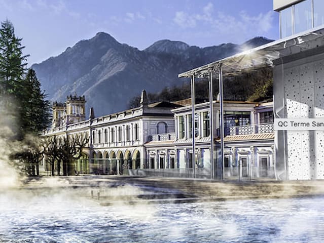
What to do when it rains? Enjoying the thermal water of Val Brembana, in San Pellegrino terme.
Its fame precedes it: San Pellegrino Terme, a renowned tourist resort, is known throughout the world for the homonymous natural mineral water. Its source together with its therapeutic properties defined as "miraculous" by Leonardo Da Vinci, are in fact used within the thermal complex. It is perfect for a relaxing day in saunas, Turkish baths, relaxation rooms and outdoor pools.
The structure is a skilful mix of Art Nouveau style (the hall of the old casino will leave you speechless) and modern.
Remember to book!
57 lokal ang nagrerekomenda
San Pellegrino Terme
What to do when it rains? Enjoying the thermal water of Val Brembana, in San Pellegrino terme.
Its fame precedes it: San Pellegrino Terme, a renowned tourist resort, is known throughout the world for the homonymous natural mineral water. Its source together with its therapeutic properties defined as "miraculous" by Leonardo Da Vinci, are in fact used within the thermal complex. It is perfect for a relaxing day in saunas, Turkish baths, relaxation rooms and outdoor pools.
The structure is a skilful mix of Art Nouveau style (the hall of the old casino will leave you speechless) and modern.
Remember to book!
Child friendly
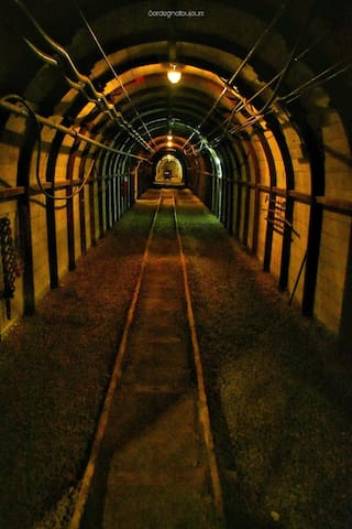
The Gaffione mine or Schilpario mine is one of the most important mining complexes in Lombardy, located at an altitude of 1200 m within the Orobie Park. Inside there are several paths that are part of the 60 existing in the Schilpario mining complex and which can be traveled partly on board a train that leads along an original stretch of the mine railway, and partly on foot.
The visit along the original mining railway is truly unmissable and very exciting, where you will find various information panels, period photographs and tools that were used in the past by miners.
The visit lasts approximately 1 hour and 30 minutes and warm and comfortable clothing is recommended, with closed shoes. Helmets are provided by the staff outside the mine.
https://www.minieraschilpario.net/visite-guidate
6 lokal ang nagrerekomenda
Miniera Gaffione
Località GaffioneThe Gaffione mine or Schilpario mine is one of the most important mining complexes in Lombardy, located at an altitude of 1200 m within the Orobie Park. Inside there are several paths that are part of the 60 existing in the Schilpario mining complex and which can be traveled partly on board a train that leads along an original stretch of the mine railway, and partly on foot.
The visit along the original mining railway is truly unmissable and very exciting, where you will find various information panels, period photographs and tools that were used in the past by miners.
The visit lasts approximately 1 hour and 30 minutes and warm and comfortable clothing is recommended, with closed shoes. Helmets are provided by the staff outside the mine.
https://www.minieraschilpario.net/visite-guidate
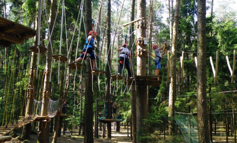
Near our accommodation there is the Adventure Park in Pineta from April to September.
Suspended park with acrobatic routes, Tibetan bridges, suspended walkways, Tyrolean, among the trees immersed in the pine forest, in compliance with safety regulations.
The structure provides 8 different routes for all levels of difficulty and age (from 3 years), it is the ideal place to spend a day full of fun for the whole family!
https://www.parcoavventurainpineta.it
7 lokal ang nagrerekomenda
Pakikipagsapalaran sa Pineta Park
Near our accommodation there is the Adventure Park in Pineta from April to September.
Suspended park with acrobatic routes, Tibetan bridges, suspended walkways, Tyrolean, among the trees immersed in the pine forest, in compliance with safety regulations.
The structure provides 8 different routes for all levels of difficulty and age (from 3 years), it is the ideal place to spend a day full of fun for the whole family!
https://www.parcoavventurainpineta.it
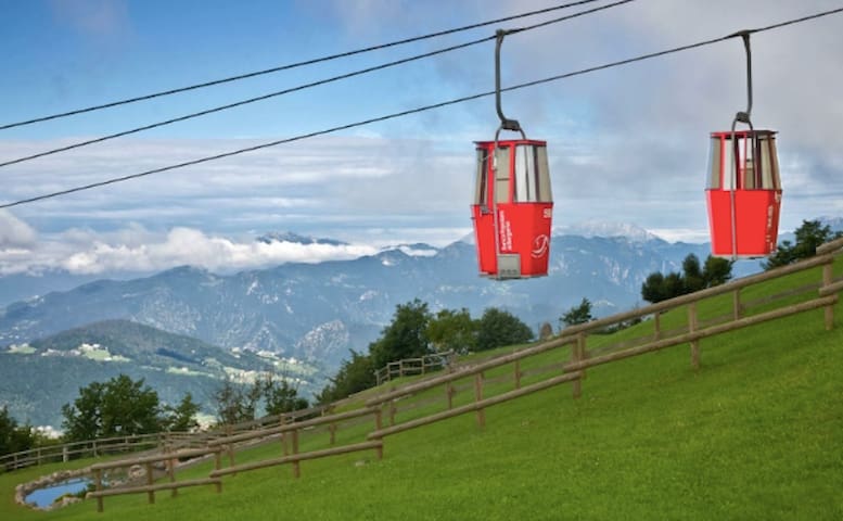
Monte Poieto is the ideal place to spend a day with the family surrounded by greenery; the refuge is an excellent support point and outside the games and the fallow deer park are ideal for children.
We start from the valley station of the Aviatico cable car (1023 m), near the ticket office, and follow the signs for the “red path”. We climb along the meadows until we reach the agrosilvopastorale road and, continuing on the same, about 300 m after passing under the cable car we find the indication for Monte Poieto (1312 m). Once we reach the "Barec" basin, where you can admire a tiny lake full of water lilies, the last tear in the gully along the former ski slope that takes us to the Monte Poieto Refuge (1360 m) awaits us. From here the view is wonderful .. and on clear days you can see the grandeur of Monte Rosa.
Mount Poieto
Monte Poieto is the ideal place to spend a day with the family surrounded by greenery; the refuge is an excellent support point and outside the games and the fallow deer park are ideal for children.
We start from the valley station of the Aviatico cable car (1023 m), near the ticket office, and follow the signs for the “red path”. We climb along the meadows until we reach the agrosilvopastorale road and, continuing on the same, about 300 m after passing under the cable car we find the indication for Monte Poieto (1312 m). Once we reach the "Barec" basin, where you can admire a tiny lake full of water lilies, the last tear in the gully along the former ski slope that takes us to the Monte Poieto Refuge (1360 m) awaits us. From here the view is wonderful .. and on clear days you can see the grandeur of Monte Rosa.
Winter Time
Ski resort - child friendly
With its seven slopes and snow park, skiing in Lizzola is ideal for young people and families. Its ski slopes extend from 1,250 to over 2,000 meters and host two mountain huts.
Skiing in Lizzola also means exploring adventurous nature trails on mountaineering skis or snowshoes to admire unique landscapes. For the little ones, a school camp with a treadmill. And during the summer downhill season.
Slopes: 7 (2 difficult - 3 medium - 2 easy)
Km of slopes: 20
Snow Park area
School camp area with "treadmill"
Skating rink: natural open field (open only during the Christmas period)
Lizzola
Ski resort - child friendly
With its seven slopes and snow park, skiing in Lizzola is ideal for young people and families. Its ski slopes extend from 1,250 to over 2,000 meters and host two mountain huts.
Skiing in Lizzola also means exploring adventurous nature trails on mountaineering skis or snowshoes to admire unique landscapes. For the little ones, a school camp with a treadmill. And during the summer downhill season.
Slopes: 7 (2 difficult - 3 medium - 2 easy)
Km of slopes: 20
Snow Park area
School camp area with "treadmill"
Skating rink: natural open field (open only during the Christmas period)
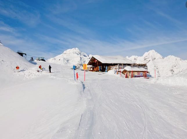
Ski area - child friendly
In Monte Pora, thanks to the excellent exposure to the sun, you can ski all day: the 20 slopes are regular, wide and some challenging for the more experienced. Snow park, illuminated slope in the evening, snowmobiles, school camp and Easy Ski Bikes and shelters make this place suitable for every adventurer, even the smallest.
It is also possible to ski at night on the Malga Pora - Pian del Termen slope! While on Friday evening, for those who want to dine in the refuge, transport by snowmobile is organized for an even more fun evening.
To enjoy the spectacular panorama from Monte Alto, snowshoe hikers and ski mountaineers can take the various dedicated routes.
Slopes details:
Slopes: 20 (7 easy - 11 medium - 2 difficult)
Km of slopes: 22
2 school camp areas with "treadmill" (Colle Vareno and Pian del Termen)
Skating rink: natural open field in the Colle Vareno area (possibility to rent skates)
Easy Ski Bike
Snowmobile excursions
Monte Pora Ski School
14 Via Pian del TermenSki area - child friendly
In Monte Pora, thanks to the excellent exposure to the sun, you can ski all day: the 20 slopes are regular, wide and some challenging for the more experienced. Snow park, illuminated slope in the evening, snowmobiles, school camp and Easy Ski Bikes and shelters make this place suitable for every adventurer, even the smallest.
It is also possible to ski at night on the Malga Pora - Pian del Termen slope! While on Friday evening, for those who want to dine in the refuge, transport by snowmobile is organized for an even more fun evening.
To enjoy the spectacular panorama from Monte Alto, snowshoe hikers and ski mountaineers can take the various dedicated routes.
Slopes details:
Slopes: 20 (7 easy - 11 medium - 2 difficult)
Km of slopes: 22
2 school camp areas with "treadmill" (Colle Vareno and Pian del Termen)
Skating rink: natural open field in the Colle Vareno area (possibility to rent skates)
Easy Ski Bike
Snowmobile excursions
A ski area at 2200 meters, framed by the highest peaks of the Orobie, where snow is present throughout the season. Thanks to its exposure, you can ski in Colere from December to May and enjoy the magnificent views of the Eastern Orobie and the Adamello chain.
The slopes of Colere are ideal for non-beginner skiers and snowboarders, with slopes up to 7 km and elevation gains of 1200 meters.
The Colere Ski Area 2200 is one of the few ski resorts in Lombardy with slopes approved for international downhill and super-giant competitions.
Slopes details:
Slopes: 9 (1 easy - 6 medium - 2 difficult)
Km of slopes: 26
School camp area with "treadmill"
Tata ski: entertainment service for children aged 3 to 6 with ski school, games in the snow and games in the heated area
8 lokal ang nagrerekomenda
Colere Ski Area 2200
28 Via CarboneraA ski area at 2200 meters, framed by the highest peaks of the Orobie, where snow is present throughout the season. Thanks to its exposure, you can ski in Colere from December to May and enjoy the magnificent views of the Eastern Orobie and the Adamello chain.
The slopes of Colere are ideal for non-beginner skiers and snowboarders, with slopes up to 7 km and elevation gains of 1200 meters.
The Colere Ski Area 2200 is one of the few ski resorts in Lombardy with slopes approved for international downhill and super-giant competitions.
Slopes details:
Slopes: 9 (1 easy - 6 medium - 2 difficult)
Km of slopes: 26
School camp area with "treadmill"
Tata ski: entertainment service for children aged 3 to 6 with ski school, games in the snow and games in the heated area
The "ski gym" of Bergamo, a child-friendly paradise. The ideal place to learn to ski.
It features gentle slopes for beginners, a treadmill and an educational track. In addition, the first Lombard center specialized in teaching skiing to the handicapped was born here.
Easily accessible, at the foot of the Presolana, the Donico slopes are an outdoor amusement park even in summer: bobsleigh on wheels, archery, downhill, mini bike-park and easy-bikes!
Scuola Sci Presolana
7 Via DonicoThe "ski gym" of Bergamo, a child-friendly paradise. The ideal place to learn to ski.
It features gentle slopes for beginners, a treadmill and an educational track. In addition, the first Lombard center specialized in teaching skiing to the handicapped was born here.
Easily accessible, at the foot of the Presolana, the Donico slopes are an outdoor amusement park even in summer: bobsleigh on wheels, archery, downhill, mini bike-park and easy-bikes!
Alpine skiing and cross-country skiing
Spiazzi di Gromo is located not far from the village of Gromo, it is the ideal place to ski together with the family, thanks to 3 easy slopes, and also appreciated by experts for its black and red slopes.
The Vodala Refuge at an altitude, at 1700 m, is an excellent refreshment, with a solarium area and an outdoor children's area.
Slopes details:
Slopes: 9 (4 easy - 2 medium - 3 difficult)
Km of slopes: 15
School camp area with "treadmill"
Skating rink: covered natural field at the Hotel Spiazzi (possibility to rent skates)
Bobsleigh and toboggan run: near the ticket office
Cross-country ski track: 1200 m above sea level, 5 km route
Routes marked for ski mountaineers and snowshoers
Refuge open at night for ski mountaineers and snowshoers
Gattobus (group tour on the snowmobile)
I.ri.s. - Impianti di Risalita Spiazzi
7 Piazzale AvertAlpine skiing and cross-country skiing
Spiazzi di Gromo is located not far from the village of Gromo, it is the ideal place to ski together with the family, thanks to 3 easy slopes, and also appreciated by experts for its black and red slopes.
The Vodala Refuge at an altitude, at 1700 m, is an excellent refreshment, with a solarium area and an outdoor children's area.
Slopes details:
Slopes: 9 (4 easy - 2 medium - 3 difficult)
Km of slopes: 15
School camp area with "treadmill"
Skating rink: covered natural field at the Hotel Spiazzi (possibility to rent skates)
Bobsleigh and toboggan run: near the ticket office
Cross-country ski track: 1200 m above sea level, 5 km route
Routes marked for ski mountaineers and snowshoers
Refuge open at night for ski mountaineers and snowshoers
Gattobus (group tour on the snowmobile)